Just a quick heads up – some of the links I share on this site are affiliate links. That means if you click on one and make a purchase, I may earn a small commission at no extra cost to you. Your support through these links helps me create valuable content.
There’s a lot to love about Malta and Gozo, from the history and the beaches to the breathtaking landscapes. However, most visitors and locals don’t realise how many trekking opportunities the islands have. Discover the best hiking trails in Malta and Gozo, from scenic walks along the coast to challenging climbs with stunning views.
I moved to Malta in 2011. I’ve explored its islands while hiking. There are numerous trails to choose from, making planning overwhelming. That’s where I can help. I’ve hiked extensively and will my favourite trails with you.
In this guide, you’ll find the best hikes in Malta and Gozo. You have included a summary of each trail’s length, the fitness level needed, and start and finish points. I hope to inspire you to explore Malta and Gozo through hiking and make your adventure as smooth and enjoyable as possible.
Malta Hiking Trails
Victoria Lines Hike
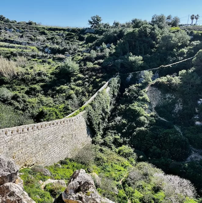
My first recommendation is the Victoria Lines hike. It follows a historical defensive line that runs the length of Malta.
During this hike, you can explore the protective wall and fortifications. Hiking along this trail offers majestic views of the Mediterranean Sea and the Maltese countryside.
In 1897, these 12 km lines were built in honour of Queen Victoria’s Diamond Jubilee. They aimed to defend Grand Harbour against invading northern forces.
It’s truly a great hike, but navigating it can be challenging. There are no signposts, and some parts of the wall are damaged. Use the Komoot map below and be aware of private property signs.
There are a few hike options you can choose from. They differ in length and difficulty levels.
Fort Madliena to Naxxar and Fort Bingemma to Dwerja Lines are some of the most scenic sections. However, if you want some challenge, hike along the entire length of the Victoria Lines.
Use my detailed guide with maps to plan your Victoria Lines hike.
Here are the details for the section that is from Kuncizzjoni to Mosta:
- Route: Kuncizzjoni to Mosta (one-way)
- Starting Point: Kuncizzjoni
- Finish Point: Mosta Bride Garden
- Distance: 9,18 km
- Walking Time: 2 h 28 mins
- Level: Intermediate
- Complete Guide to Victoria Lines Hike
This section is short but gives you a glimpse of the Victoria Lines. It’s from Fort Madliena to Naxxar.
- Route: Fort Madliena to Naxxar (one-way walk)
- Starting Point: Fort Madliena
- Finish Point: Naxxar
- Distance: 2,80 km
- Walking Time: 47 mins
- Level: Easy
- A Full Guide to Victoria Lines Hike
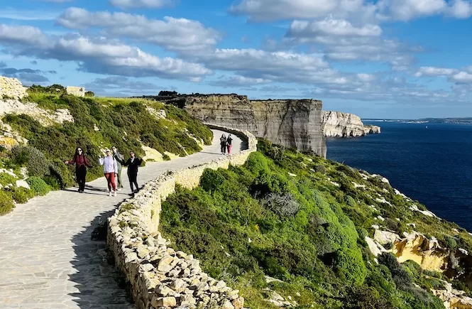
Selmun Circular Hike
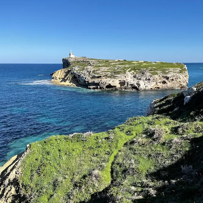
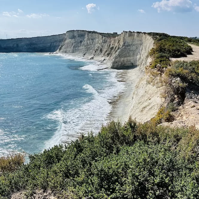
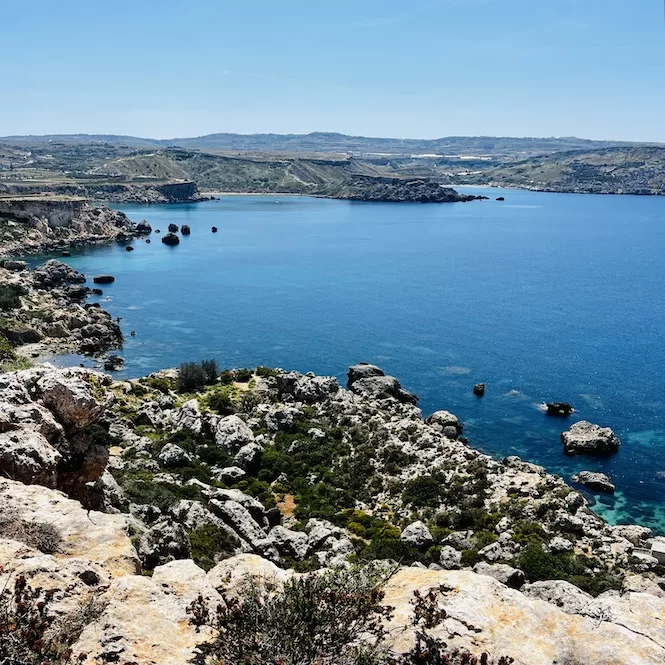
The Selmun Circular Hike is an 8 km trail in the North East of Malta. On the trek, you’ll see Selmun Palace, Imgiebah Beach (also called Selmun Beach), and St. Paul’s Island, some of Malta’s most iconic locations.
During the walk, you’ll pass terraced fields and clay cliffs. Then, you follow a coastal path that offers beautiful views of the Mediterranean.
The hike starts at Selmun Palace, built by the Knights of St. John. In the days of the Knights of Malta, this was the best hunting lodge.
Then, there’s a trail downhill that leads to Imġiebaħ Beach. Rugged cliffs surround this secluded and peaceful beach, making it even more picturesque. It’s a gorgeous photo spot with all the colourful flowers on the cliffs.
After visiting Imġiebaħ Beach, you will walk uphill to the clay cliffs. You will enjoy stunning views of the limestone coast and St. Paul’s Island. This island is famous for its statue of St. Paul and its association with the biblical story of Paul’s shipwreck on his way to Rome.
It’s a fantastic hike, a must-do if you’re into nature.
- Route: Selmun Palace – Imgiebah Beach – St Paul’s Island (circular walk)
- Starting & Finish Point: Selmun Palace
- Distance: 7,88 km
- Walking Time: 2 h 12 mins
- Level: Intermediate
- Selmun Circular Walk Guide
Get a FREE Attractions Map
Planning a trip to Malta, Gozo, or Comino? Get this free interactive map filled with insider tips, Google Maps links, and more.
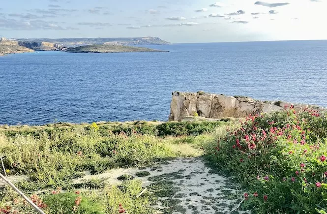
Paradise Bay Circular Hike
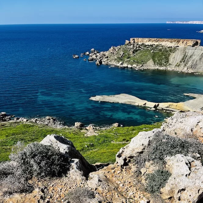
Paradise Bay Circular Hike takes you through some of the best parts of Malta’s north. The hike starts at Paradise Bay Beach, surrounded by cliffs and rocks. People enjoy swimming, sunbathing, and snorkelling there.
You’ll pass through a cave, a natural limestone sinkhole. Then, you’ll get breathtaking views of Gozo and Majjistral Park during the walk. Also, you’ll see Il-Minzel l-Abjad, a rocky plate full of giant stones.
The hike ends at the Red Tower, which offers panoramic views of the surrounding area. The Red Tower is a popular tourist spot. From Red Tower, the hike will take you back to Paradise Bay, completing the circular walk.
This hike is a true paradise with its diverse landscape, unique rock formations, and panoramic views.
- Route: Paradise Bay to Red Tower (return walk)
- Starting & Finish Point: Paradise Beach Parking Area
- Distance: 8 km
- Walking Time: 2 h 18 mins
- Level: Intermediate
- Paradise Bay to the Red Tower Circular Hike
St Thomas Bay to St Peter’s Pool
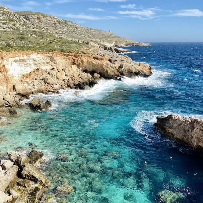
The St Thomas Bay to St. Peter’s Pool hike is a unique and rewarding experience. It is perfect for hikers who want to explore Malta’s beautiful southern coast.
This walk offers a variety of stunning scenery, including white limestone cliffs, lush greenery and crystal-clear waters. Along the way, you will encounter a natural arch and several secluded beaches and bays.
The path can sometimes be challenging as it goes along cliffs and rocky terrain. But, it is well worth the effort, as the views are breathtaking.
The St Thomas Bay to St. Peter’s Pool hike is a must-try. The hike’s stunning scenery, unique geology, and hidden beaches make it unique.
- Route: St Thomas Bay to St. Peter’s Pool (return walk)
- Start & Finish Point: St Thomas Bay
- Distance: 8,87 km
- Walking Time: 2 h 15 mins
- Level: Intermediate
- A Guide to Hiking in Malta South
Ghajn Tuffieha to Gnejna Bay Hike
This picturesque hike from Ghajn Tuffieha to Gnejna Bay takes you from one beach to another. As you hike along this route, you will see some interesting coastal rock formations and lush green hills and clay cliffs.
You will discover hidden beaches, secluded coves and breathtaking views. No wonder this is one of Malta’s most ‘Instagrammable’ spots.
While this hike is short, it can be challenging. You have to climb some hills and navigate slippery rocks and loose gravel.
The hike starts at Ghajn Tuffieha parking and follows the coast until you reach Gnejna Bay. You can return the same way or choose another parallel path.
Some interesting sites can be seen along the way, including the il-Qarraba peninsula, clay cliffs, and Ta’ Babu Cove, as well as the old Lippija Tower, which is a great spot to stop and take in the views.
- Route: Ghajn Tuffieha to Gnejna Bay (return walk)
- Start & Finish Point: Parking Next To Ghajn Tuffieha Beach
- Distance: 3,95 km
- Walking Time: 1 h 19 mins
- Level: Intermediate
- A Ghajn Tuffieha to Gnejna Hike Guide
From Ancient Temples to a Natural Pool
This walk from UNESCO megalithic temples to Ghar Lapsi is a must-do. It reveals Malta’s ancient past as well as its breathtaking natural beauty.
There is some fantastic scenery on this hiking trail in Malta. With its rugged and unspoiled coastline, secluded coves and turquoise waters, I’m sure you’ll stop to take many pictures.
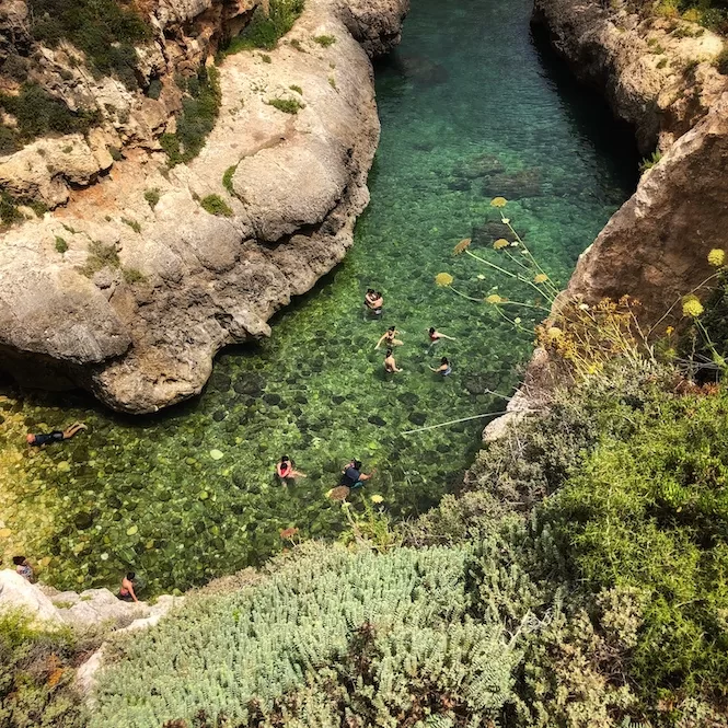
It is during this hike that you will see Filfla, Malta’s southmost point, an uninhabited island. Last but not least, you’ll visit Ghar Lapsi, which is a beautiful natural pool. The clear water is surrounded by algae-covered rocks where you can spot small fish.
The route takes you along the cliff’s edge, so be careful. If you’re afraid of heights, this hike might not suit you.
- Route: Hagar Qim to Ghar Lapsi (return walk)
- Start & Finish Point: Haġar Qim Park Visitor Centre.
- Distance: 5,58 km
- Walking Time: 1 h 22 mins
- Level: Intermediate
- A Guide to a Hike from Ancient Temples to Ghar Lapsi
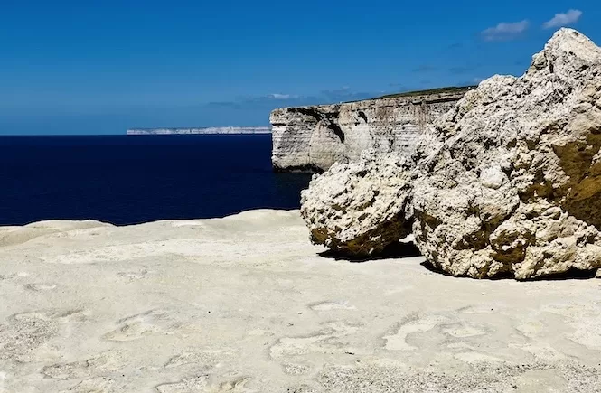
Il-Blata tal-Melh Hike
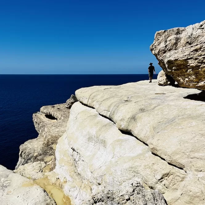
One of Malta’s wildest, untouched areas is Il-Blata tal-Melh. The hike offers amazing rock formations, majestic cliffs, and moon-like scenery. The trail is steep and slippery, so wear sturdy shoes and be careful.
It takes about five to ten minutes from the start of the hike to reach a rocky plateau. You will see white cliffs that look surreal. They have wavy surfaces and striking contrast with blue skies and sea.
The hike of Il-Blata tal-Melh is very short, so I recommend adding a walk to Fomm ir-Rih viewpoint. Fomm ir-Rih is a bay north of Il-Blata tal-Melh, with vertical cliffs, turquoise waters and a pebble beach.
You can walk down the cliff via a narrow path, but the pebbles are covered in clay because of a recent storm.
- Route: To Il-Blata tal-Melh and back, then to Fomm ir-Rih viewpoint and back (return walk)
- Start & Finish Point: Parking area near Il-Blata tal-Melh
- Distance: 4,24 km
- Walking Time: 1 h 13 mins
- Level: Intermediate
- A Guide to Il-Blata tal-Melh
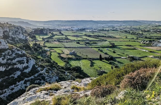
Majjistral Park Hiking Trail
Mellieha’s Majjistral Nature and History Park is Malta’s only nature park. It offers stunning coastal views, pristine biodiversity, and a rich cultural heritage.
In the past, the site was used for military training. Since its designation as a national park in 2007, Majjistral Nature and History Park has become increasingly enriched with various plants and flowers. The beauty of this area increases every year.
The park has multiple entrances, but I recommend starting at the Radisson Blu Hotel. An incredible view of Golden Bay will be your first experience. It’s a fantastic sight of blue water with many boats shimmering in the sun.
Further along, you’ll see a few natural wild bays. Also, there is a path down to the blue clay cliffs and secluded pebble beaches. Another picturesque attraction is a rock-cut observation point. At the end of the hike, you will arrive at Anchor Bay and see Popeye Village.
- Route: from Golden Bay to Anchor Bay (you can return using another path)
- Start & Finish Point: Radisson Blu Hotel, Golden Bay
- Distance: 8,95 km
- Walking Time: 2 h 29 mins
- Level: Intermediate
- Majjistral Park Hiking Guide
Hiking Trails in Gozo
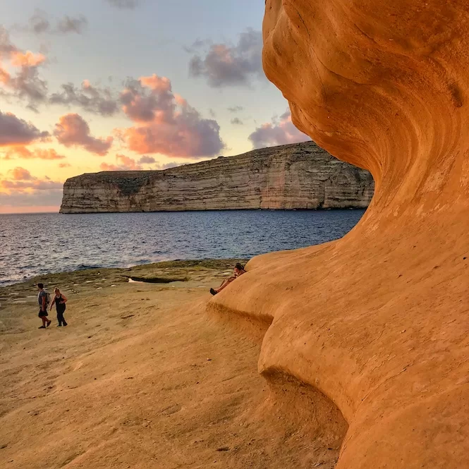
Mgarr Harbour to Xlendi Hike
Hiking from Mgarr Harbour to Xlendi in Gozo is a picturesque trek. On this hike, you’ll pass Xatt l-Amar Bay, medieval watchtowers, Mgarr Ix-Xini, and Sanap cliffs, one of Gozo’s tallest.
On the way to Xatt l-Aħmar Bay, you’ll walk through red clay cliffs. At Xatt l-Amar Bay, you can relax and enjoy the peaceful surroundings.
You’ll then walk to Mgarr ix-Xini, a gorgeous inlet. First, you will pass a watchtower, one of the coastal watchtowers built by the Knights of Malta. Next up is Mgarr Ix-Xini Bay. It is a scenic spot surrounded by high cliffs with sand at the bottom, making the water turquoise.
The last part of the hike takes you along the cliffs. There’s a breathtaking view of Gozo, Malta and Comino from here.
The hike ends in Xlendi, a scenic coastal village. You’ll get there through Xlendi Tower, Gozo’s oldest watchtower. It’s a pretty spot. The yellow limestone coast contrasts beautifully with the blue ocean.
- Route: Mgarr Harbour to Xlendi (one-way walk)
- Starting Point: Parking Next To Mgarr Harbour
- Finishing Point: Xlendi
- Distance: 12,1 km
- Walking Time: 3 h 20 mins
- Level: Intermediate
- Mgarr Harbour to Xlendi Trail Guide
Xwejni Bay to Wied il-Ghasri Coastal Hiking Trail
Another suggestion for Gozo is a hike along the northeast coast. The Xwejni Bay to Wied il-Ghasri Valley hike is a 4.50 km round trip; anyone can do it. This hike takes you past salt pans, deep blue water along the coast, steep limestone cliffs, and a small canyon-like valley.
The starting point of this hike is Xwejni Bay. Next, you’ll pass salt pans, a unique part of the island’s history. You’ll also walk on limestone cliffs, where you’ll come across fossils. As you pass Billinghurst Cave, you’ll see deep blue waters.
Towards the end, you’ll see Wied il-Gasri Valley, a sea canyon. The tiny pebbly beach is down the stairs here. Swim or listen to the waves crashing into the valley’s steep cliffs.
- Route: Xwejni Bay to Ghasri Valley (return walk)
- Starting & Finish Point: Xwejni Bay
- Distance: 4,54 km
- Walking Time: 1 h 10 mins
- Level: Intermediate
- A Guide from Xwejni Bay to Ghasri Valley
Tips for Hiking in Malta and Gozo
- Make sure you wear comfortable, supportive shoes, lightweight clothing, a hat and sunscreen. Bring a light jacket if you’re hiking in the winter.
- Bring plenty of water with you, especially on hot days.
- Make sure you have a hiking map on your phone for offline use. There are some remote places where the internet is unavailable.
- Take your litter with you.
- The weather can change quickly in Malta and Gozo, so be prepared for rain and strong winds.
- Make sure you have bandages and pain medication in your bag.
- Keep track of the time and ensure you start and finish your hike before dusk.
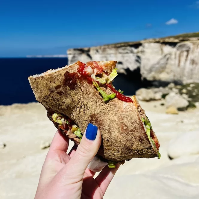
- On most hikes, food isn’t available, so bring food with you. My favourite hiking lunch is Ftira biz-Zejt, a traditional Maltese bread with tuna. It can be bought at many shops and snack kiosks.
Hiking in Malta and Gozo is an unforgettable experience that takes you through scenic views and breathtaking landscapes.
Hopefully, the information in this guide has inspired you to plan your hike in Malta or Gozo. Hiking is a great way to get out of the city and connect to nature.
If you want more, check out this post about Gozo’s coastal hikes. Also, check out this link to see all my hiking guides that also include some lesser-known hikes in Malta that are not featured in this article.
Have questions about your Malta trip? Join my FREE private Facebook group, Malta Travel Tips, where you can find helpful resources and connect with fellow travellers!