Just a quick heads up – some of the links I share on this site are affiliate links. That means if you click on one and make a purchase, I may earn a small commission at no extra cost to you. Your support through these links helps me create valuable content.
The Selmun Palace circular walk is one of the best hikes in Malta. It guides you through three iconic places in Malta: Selmun Palace, Imgiebah Beach, and St. Paul’s Island.
If you’re looking to escape busy tourist areas, this hike is perfect. It offers fresh air and breathtaking scenery, making it an ideal adventure for those wanting to explore Malta’s beauty.
Since moving to Malta in 2011, I’ve loved exploring its hidden nature trails. I enjoy nature and water sports, and I usually spend my weekends hiking.
If you’re into nature and stunning views, you’ll like this trekking guide. This walk is one of the best hikes in Malta and suits anyone seeking a calm day outdoors.
Selmun Palace Circular Walk Details:
- Distance: 7.88 km
- Walking Time: 2 h 12 mins
- Level: Intermediate
- Uphill: 150 m
- Downhill: 150 m
- Highest Point: 100 m
Best time to go: anytime, but avoid mid-day heat between June and September.
Selmun Palace Circular Walk: The Hiking Map
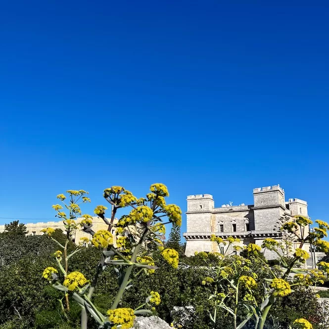
Selmun Palace – the Starting Point of the Hike
The hike starts at Selmun Palace. Malta’s Selmun Palace is a gorgeous historic landmark in Malta, built by the Knights of St John in 1783. The renowned architect Duminku Cachia was responsible for its baroque design. According to some, it’s like Verdala Palace in Buskett Gardens!
When the Knights of Malta owned this land, it was known as one of the finest hunting lodges. In recent history, ceremonies like weddings used to be celebrated in this palace.
Unfortunately, it’s not open to the public anymore, but plans are to renovate it and open it again soon. You can look outside, but don’t go inside as it could be dangerous.
Getting to Selmun Palace is pretty straightforward if you have a car. Below are the exact directions and parking info.
Getting here by bus requires taking one to Cirkewwa and getting off at the Barkazza stop in Mellieha. This is 15 minutes from Selmun Palace. Bus journeys can take longer, so leave plenty of time for that.
You can get around Malta and Gozo by public transportation, but it takes a lot of time. I suggest renting a car. Check out my guide to renting a car in Malta.
Getting There:
- Location: link to Google Maps
- Nearest bus stop: Barkazza
- Walking distance from the bus stop: 15-20 mins, 1.3 km
- Bus frequency: every half an hour
- Parking available: there is ample space on the road near Selmun Palace
Għajn Ħadid Beach
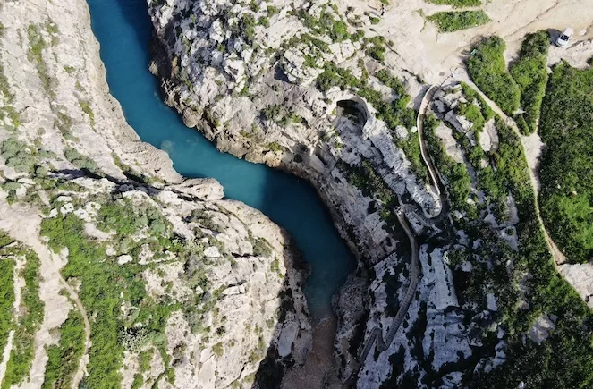
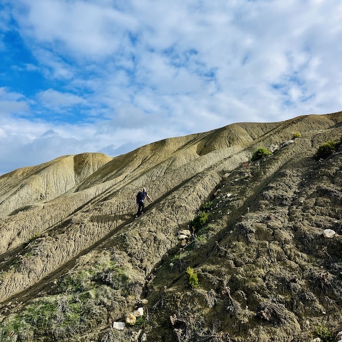
Afterwards, hike downhill on a quiet road lined with lush green terraced fields. A 2-kilometre walk will lead you to a view of the sea and clay cliffs.
The road ends there, so you’ll have to take a steep path to go down. Be careful; the rocks might be unstable.
The clay cliffs are on your left.
Nature does amazing things with clay cliffs. Whenever the sun shines, it reflects off the surface like a glossy glacier.
Keep walking down the path until you reach a small bay called Ghajn Hadid.
Ghajn Hadid is a cute and secluded beach. Its name originates from the ruins of Għajn Ħadid Tower, located right above the shore. Even though it’s small, it offers plenty of privacy. Also great for picnics in the cooler months.
Imgiebah Beach
Then you can go left to Imgiebah Beach (also called Selmun Beach or Selmun Bay) or right to continue the Selmun Palace circular walk. I recommend visiting Imgiebah Beach. If you don’t, your walk will be shorter by a few kilometres.
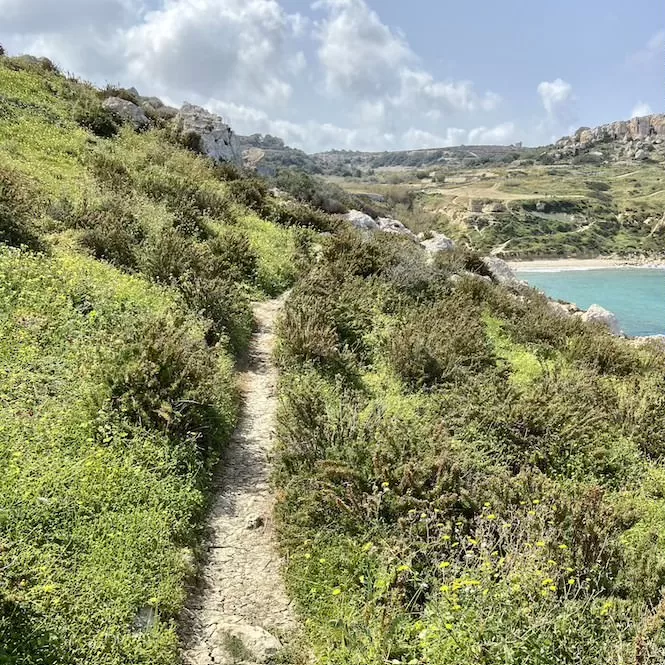
Imgiebah Beach is a beautiful pebble beach. This is indeed a paradise in summer but also a great hiking spot in winter. On the way, you’ll enjoy stunning shorelines, cliffs and green fields.
Take a break at the beach and get something to eat. This beach is one of the few dog-friendly beaches. It’s the happiest place to let your dog play with you! So if you like a challenge, don’t skip the walk to Imgiebah Beach.
Follow the same route back to the Ghajn Hadid Bay after visiting the Imgiebah Beach.
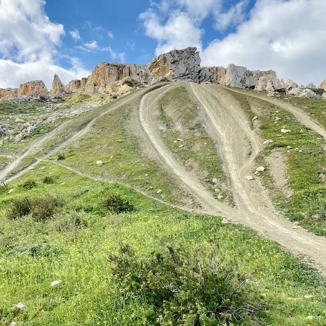
After, you’ll hike uphill to the clay cliffs. Take it slow, especially if the cliffs are slippery. Keep an eye out for motorbikes. This area is popular with off-road bikers.
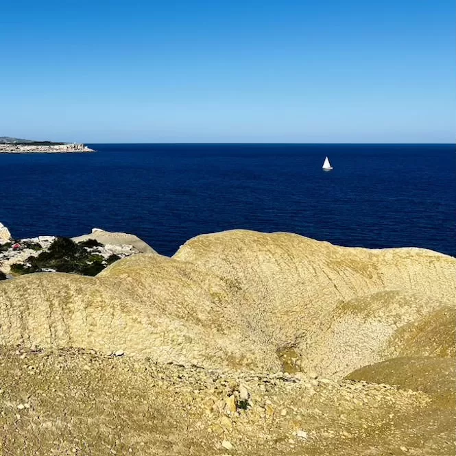
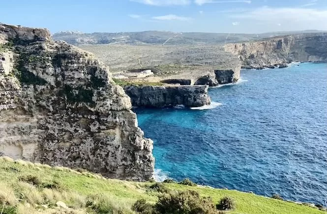
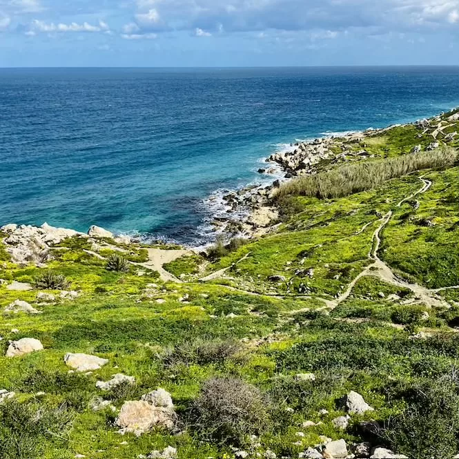
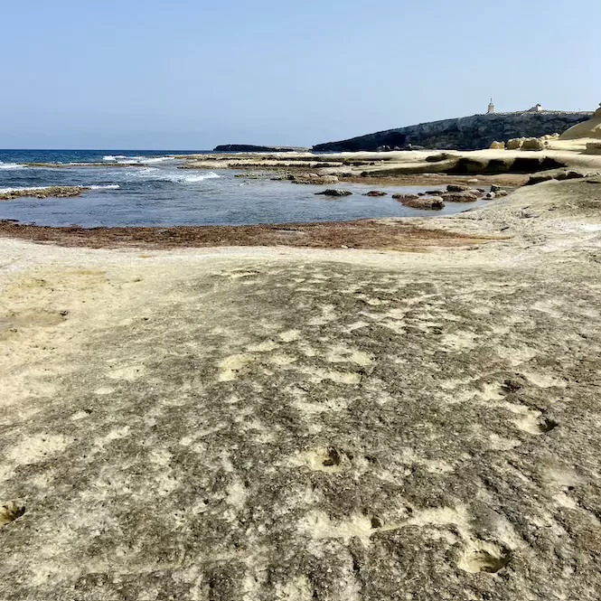
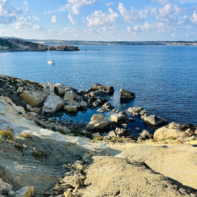
Limestone Coast on the Selmun Palace Circular Walk
At the top, the path winds down. Turn left at the end to see the limestone coast. There is so much beauty in rocky shorelines. Waves create arches and sea stacks. Look under your feet for shells and sea urchin fossils on this hike.
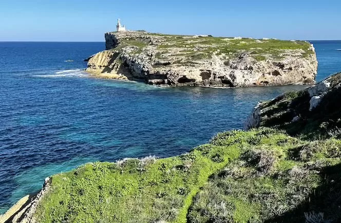
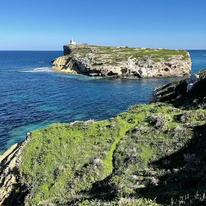
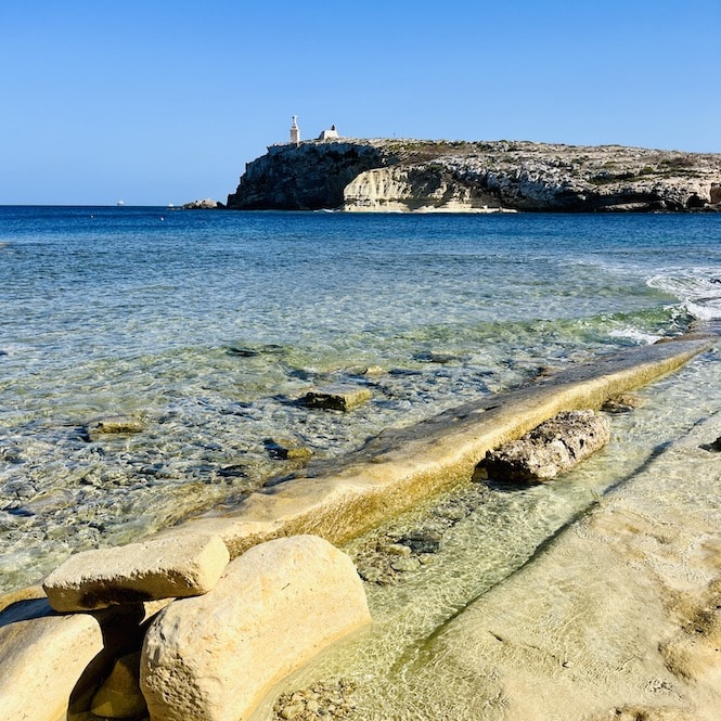
St. Paul’s Island
St. Paul’s Island, also known as Selmunett, is a renowned historical site in Malta. The only structure standing is the statue of St. Paul. Seen from miles away, it was built in 1845.
According to the biblical story, Paul was shipwrecked on his way to Rome in 60 AD. Paul and his crew swam to shore and were taken care of by the Maltese people until they could proceed on their way.
In the meantime, Paul taught Christianity to the locals. According to the story, the shipwreck occurred in St Paul’s Bay, nearby St Paul’s Island.
On the Way Back to Selmun Palace
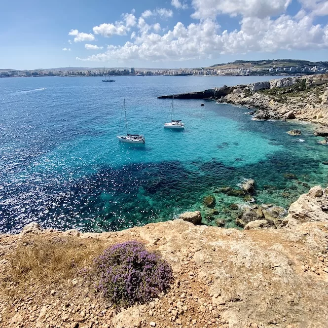
Follow the map and walk uphill along the coast after enjoying the view of St Paul’s Island.
Approximately ten minutes later, you’ll reach Ras il-Miġnuna, another fantastic viewpoint. It’s 5 meters above the sea and overlooks a crystal clear bay accessible by boat. St Paul’s Bay is visible in the distance.
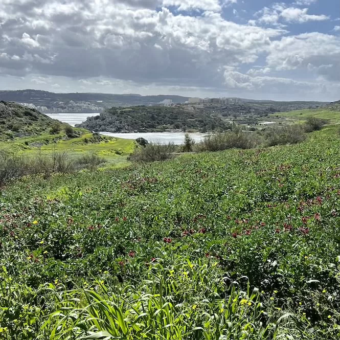
Follow the path to the right to walk inland. You’ll have to walk uphill for about 10-15 minutes, then stop to enjoy the view of the lush green valley.
At the bottom of a steep valley lies Mistra Bay. The beach isn’t big, but it’s shallow and has clear water, making it ideal for snorkelling.
Fort Campbell, a bleak reminder of the past, lies to your left. It used to be a powerful and respected military base.
In 1937 and 1938, the British built Fort Campbell to protect Mellieħa Bay and St. Paul’s Bay, as well as British seaplanes landing in Mistra Bay.
Barracks and radars were built at the fort during World War II. It’s not clear when it was decommissioned. After World War II, the military abandoned the fort, but a watchman stayed on the fort until the 1970s. Since then, Fort Campbell has fallen into disrepair and neglect.
Walk straight along the road surrounded by pine trees.
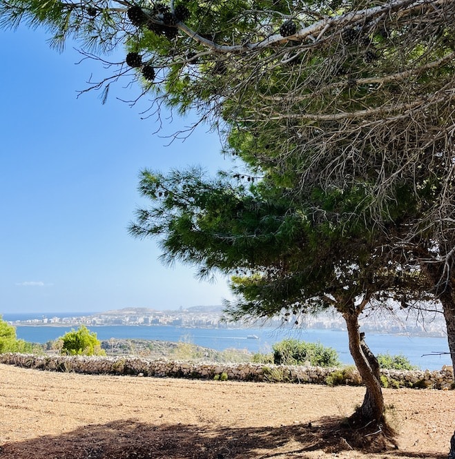
Stay alert for cars since the road is also used for driving. After about 10 minutes, you’ll be back at Selmun Palace.
Selmun Palace Circular Walk: FAQ
What to bring to the Selmun Palace circular walk?
Bring food and water, as there are no shops on the way.
Is this hike suitable for beginners?
No, it’s rather long and can be challenging with uphill and downhill paths and 150 meters of elevation
What to wear during the Selmun Palace circular walk?
Shoes with a good grip are needed as some paths can be slippery. Bring a swimsuit on warmer days for a swim.
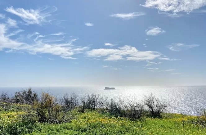
What is the best time to take this hike?
Spring is ideal when everything is green and flowery. In summer, you can swim but avoid the midday heat.
The Selmun Palace circular walk is my favourite, and probably one of the best hikes in Malta. The hike offers spectacular views and allows you to immerse yourself in history.
During the winter, the walk is especially beautiful because of the greenery and blossoms surrounding it. During the summer, it is less green, but you can enjoy swimming in one of the secluded bays.
Here is a list to other Malta hikes featured on this site. Check them out!