Just a quick heads up – some of the links I share on this site are affiliate links. That means if you click on one and make a purchase, I may earn a small commission at no extra cost to you. Your support through these links helps me create valuable content.
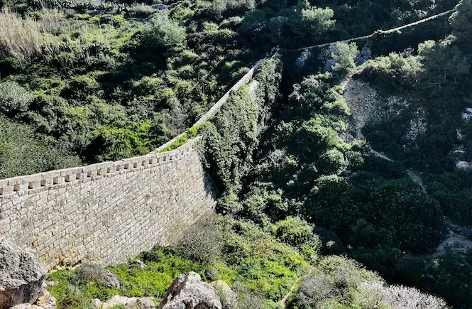
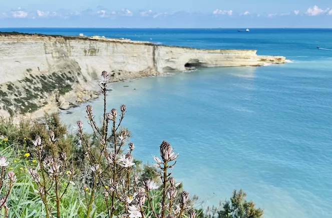
Victoria Lines is a historic defensive wall that runs across Malta. It’s one of the most scenic and peaceful trails on the island. When it’s clear, it gives you a beautiful view of the northern Malta and Gozo cliffs.
However, finding the right Victoria Lines route is tricky. While new signage is being improved (2025/2026), online misinformation is still common. But don’t worry. I have lived in Malta since 2011 and hiked this trail often. So, I’ll provide a reliable hiking map with insider tips.
I’ll give you a map for a 14 km hike on the Victoria Lines. For a shorter trek, I’ll provide two options with maps. You will also find info on key sights and helpful tips.
Geographical Location of Victoria Lines
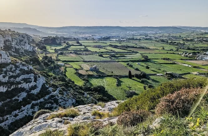
There’s a natural geographical barrier that runs along these historic defensive walls. It separates the island into higher and lower parts.
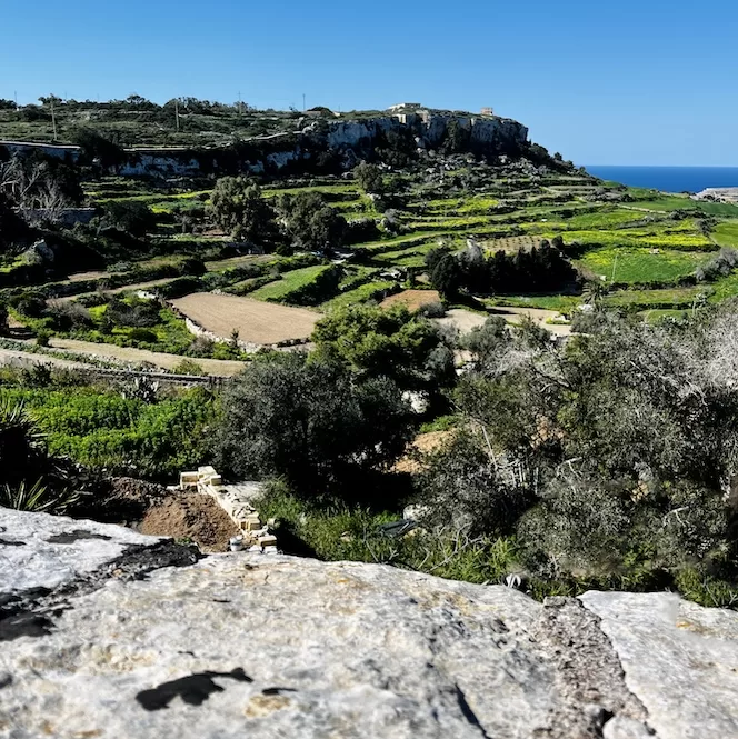
The northern part of the island is more down in altitude. The Victoria Lines run along this barrier. It’s not easy to notice it when you drive around Malta, but when you are there, it’s visible. The barrier feels like a giant step. So, while walking along the Victoria Lines trail, you always have a view of Malta’s North and Gozo.
History of the Victoria Lines of Malta
The British military built the Victoria Lines in honour of Queen Victoria’s Diamond Jubilee in 1897. They wanted to protect the area around Grand Harbor from invading forces coming from the North.
This 12 km fortification system included forts, batteries, entrenchments, stop walls, etc. In May 1900, military training exercises revealed that the Victoria Lines weren’t very effective. So, they were abandoned in the early 20th century.
Planning Your Hike Along the Victoria Lines
Navigating the Victoria Lines Route
Sadly, some parts of the Victoria Lines are destroyed. Additionally, signposts can be sporadic. So it’s hard to find your way. Some online resources describe the Victoria Line route, but getting lost is still easy.
There are also “fake” private property signs blocking some sections of the path (often put up by hunters or farmers). It’s best to use a recently updated Victoria Lines trail map. I will include the Kamoot tour map in this post. Just download their app.
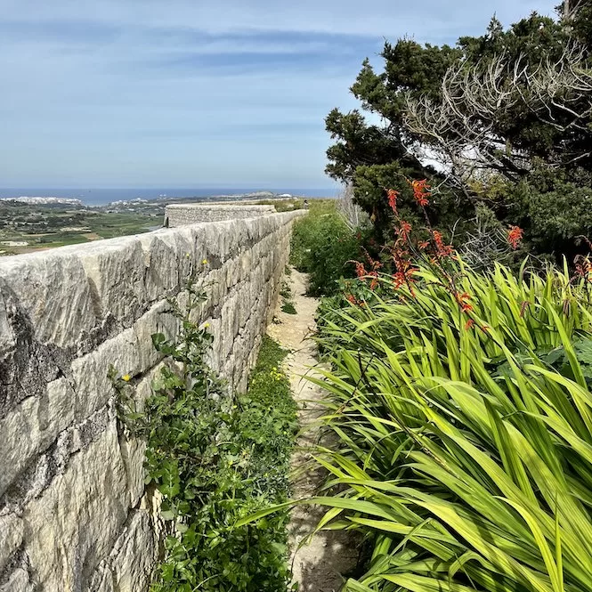
When I hiked Victoria Lines for the first time, we started from Fort Madliena. I loved the first hour of hiking. However, as soon as we got to Naxxar, the wall disappeared. It must have been destroyed because there’s a big quarry there. We looked for where the wall started again after passing through the quarry, but we couldn’t find it. So we took a taxi to Kuncizzjoni, where the trek ended. We planned to walk from west to east and finish in Naxxar.
In Kuncizzjoni, we got started walking, eager to find the trail. We walked for hours and still couldn’t find the path. We were about to give up, but then we saw the wall.
Victoria Lines Map: Hiking Options
There are a few options for you to choose from. I will list the sections of the lines below, and you can mix and match them.
The following sections are the most picturesque if you want a short walk:
- Fort Madliena – Naxxar (1 hour)
- Fort Bingemma – Dwerja Lines (45 mins)
If you want to walk the entire Victoria Lines hike, you can choose from these options:
- Kuncizzjoni – Mosta / Naxxar – Fort Madliena (west to east)
- Fort Madliena – Naxxar / Mosta – Kuncizzjoni (east to west)
- Fort Madliena – Naxxar / Kuncizzjoni – Mosta (east to west until Naxxar, then west to east)
Sadly, the Victoria lines between Mosta and Naxxar have been destroyed. Moreover, you have to walk on a busy road, so it won’t be enjoyable. I suggest taking a bus or a taxi instead. Bus 103 goes from the Mcast Mosta to Birguma bus stop in Naxxar. Alternatively, using a Bolt or Uber is affordable and saves you time.
Two sections will be described in this blog: Kuncizzjoni to Mosta and Fort Madliena to Naxxar. I also added links to the locations where the paths begin or end.
Victoria Lines Malta Map: Kuncizzjoni to Mosta (+Map)
Firstly, I will describe a hike from Kuncizzjoni to Mosta.
- Distance: 9,18 km
- Walking Time: 2 h 28 mins
- Level: Intermediate
- Uphill: 70 m
- Downhill: 200 m
- Highest Point: 230 m
If you go between June and September, try to avoid the midday heat. Wear good shoes when wet because it might be slippery.
Kuncizzjoni to Fort Bingemma
The starting point is Kuncizzjoni. Getting there by bus is possible, but buses are not frequent.
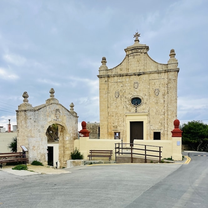
You can get there faster and easier by car or Bolt/Uber (approx €15-€20 from central areas).
Below is the exact location. On-street parking is also available.
Getting There:
- Location: link to Google Maps
- Nearest bus stop: Wied Gerzuma. This area is served by bus 109, which travels from Siggiewi via Rabat.
- Frequency of the buses: every 2 hours or less
- Parking available: Along the road, there is plenty of parking.
The Victoria lines start further west from the church (click here for the exact location). It’s better to start from the church; the initial part isn’t too interesting. Unless you’re keen on seeing military barracks over there.
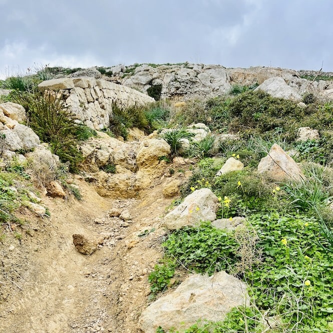
From the church, follow the dead-end road you can see if you stand your back turned to the church. You will see the wall on your left at the end of that road.
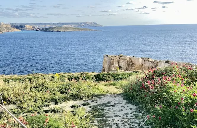
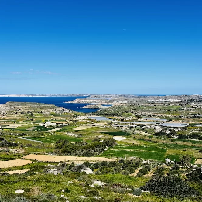
The views there are breathtaking. On a clear day, you can see Ghajn Tuffieha, Golden Bay, and the white cliffs of Gozo, Malta’s sister island.
After you follow the wall for 10 minutes, you will see a path leading down into a field marked as private. Don’t go down. Keep right and look for a way up the hill.
Sadly, the wall disappears soon after, and you must follow a village road. The good thing is that the road is relatively quiet and you can still enjoy the countryside views. You have around 20 minutes to walk to Fort Bingemma.
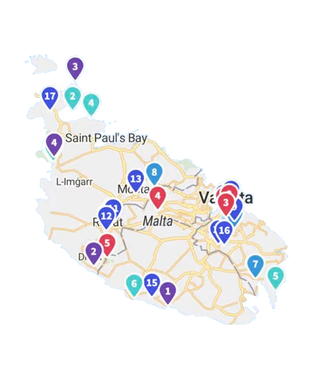
Get a FREE Attractions Map
Planning a trip to Malta, Gozo, or Comino? Get this free interactive map filled with insider tips, Google Maps links, and more.
Fort Bingemma to Bingemma Gap
Fort Bingemma was built by the British as part of the Victoria Lines between 1875 and 1878. Initially, the Fort was armed with several guns to protect the northern area of Malta. Later, it was used for military training and communications. Now the Fort is neglected but still intact.
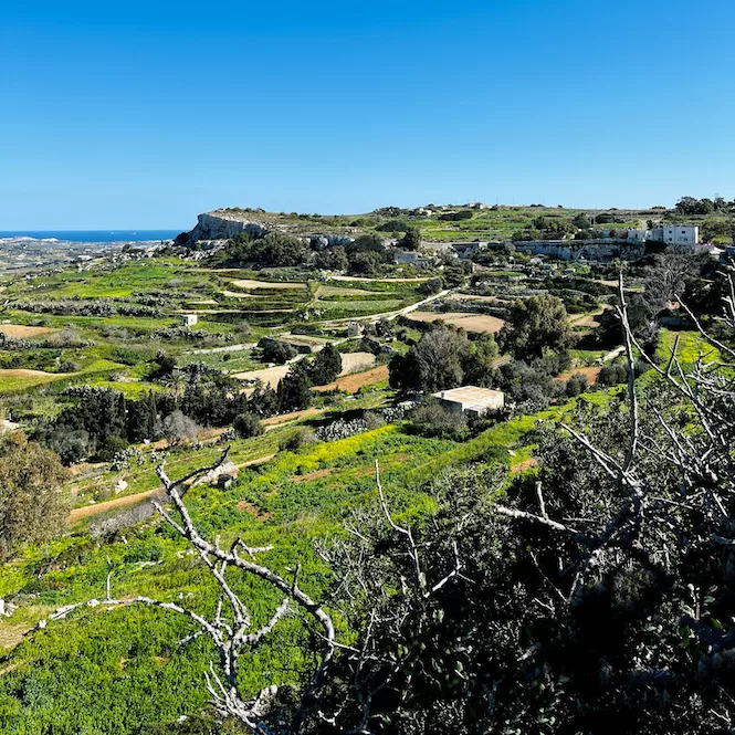
An interesting fact: The Fort was illegally occupied by a Maltese family. Since 1981, the Buttigieg family used the Fort as a farm, but their lease ended in 2009. Only in August 2025, the site was reclaimed by the government and is now managed by Xjenza Malta (Science Malta).
From the Fort, you descend a bit. It’s easy to navigate; follow the wall. On your left, you will see a deep green valley full of pine trees.
In the distance, you will see Our Lady of Hodegetria Chapel. The chapel is out of the way, but it’s worth a visit. It’s open on Sundays, but walking around in the surroundings is very rewarding.
A note for dog owners: The trail is generally dog-friendly, but keep them on a leash. There is a farm near Dwejra Lines where loose dogs sometimes run out, so stay alert in that specific section.
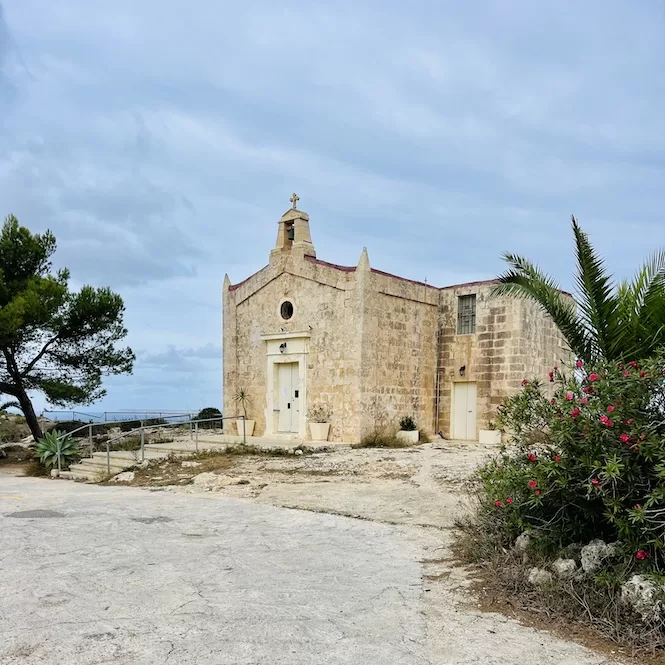
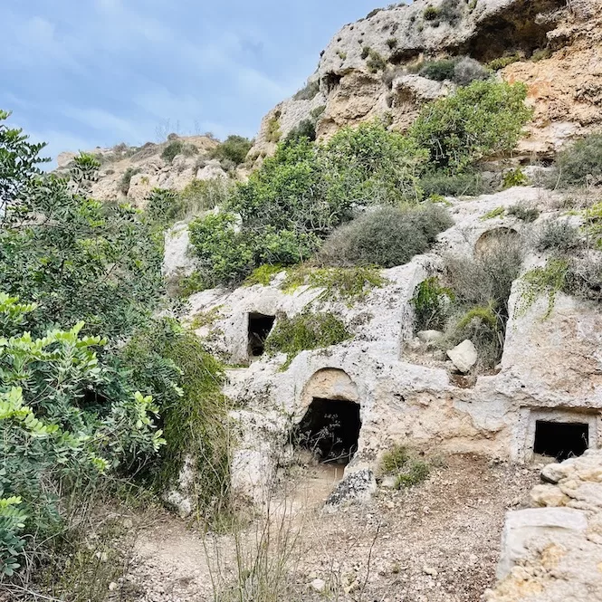
There are caves in the valley below the church. You can reach it by walking down on the right side of the church.
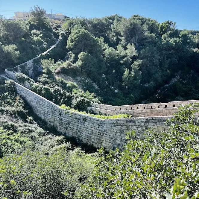
The views are amazing, and you can see a defensive bridge over a valley called Bingemma Gap. This section of the Victoria Lines walk is the most photographed.
Locals call this stretch the ‘Great Wall of Malta’, and it’s easy to see why. Make sure you check out the nearby caves carved deep into the rock.
It’s also a perfect area for a lunch break.
Experience the best of Malta without the planning stress
A clear, curated 7-day itinerary written by a local expert. Stop endless scrolling and start looking forward to your holiday.
Dwejra Lines
Keep walking uphill from the bridge until you reach a path with pine trees planted along it. You’ll also see a village road on your right.
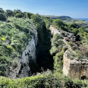
To enjoy the views, I usually follow the path. You can see both the east and west sides of Malta from here. It’s pretty incredible. The route follows a trench, part of the Victoria Lines fortifications. There are also gun emplacements visible along the way.
Sundays and public holidays are busy because many people come here for picnics or camping.
Dwejra Lines to Mosta
After crossing the Dwejra Lines, follow the path through Falka Gap and Targa Gap. It’s about 40 minutes downhill. Walking west to east, you hear cars and urban life growing louder. Between Mosta and Mgarr, a busy road crosses the Victoria Lines trail. When crossing, be careful.
Along the road are limestone quarries that are deserted on weekends. It’s a quiet part of the walk, but it’s boring and dusty. You’ll see some houses and camping areas. You will cross the road to reach the Mosta Bride Garden. In this area, the wall has been restored. This park has benches and play areas.
There’s Fort Mosta to the east. Fort Mosta was built as part of the Victoria Lines. The fort has a pentagonal shape and a battery. Fort Mosta is an ammunition depot for the Armed Forces of Malta and isn’t open to the public.
Victoria Lines Map: Fort Madliena to Naxxar (+Map)
Fort Madliena to Naxxar is the second part of the hike. Again, you can walk from west to east or east to west. I prefer walking east to west because the views are better.
- Distance: 2.80 km
- Walking Time: 47 mins
- Level: Easy
- Uphill: 50 m
- Downhill: 70 m
- Highest Point: 140 m
Try to avoid the midday heat between June and September.
Fort Madliena to the Top of The World in Gharghur
The hike starts from Fort Madliena. This Fort was built in the 19th century as part of the Victoria Lines defence system. With 132 meters of elevation, the fort offers views of Gozo to the south of Malta.
The primary purpose of the structure was to house large guns. A perimeter ditch protected the area from the outside. The fort was designed to complement the natural landscape. Today St John Rescue Corps Malta uses the fort for rescue training.
Getting There:
- Location: link to Google Maps
- Nearest bus stop: Dis (5 mins away)
- Frequency of the buses: every 20 mins
- Parking available: There is a car park and some on-street parking available.
You can enjoy the valley view as you walk towards San Giovanni Battery from Fort Madliena. This part of the walk is on the road, but it is not very busy. On the road, you’ll see some beautiful villas and trees.
There are two concrete gun emplacements at San Giovanni Battery in Madliena. They belong to the Victoria Lines. Very little of the original battery remains, but the view from the top over all the surrounding land is impressive.
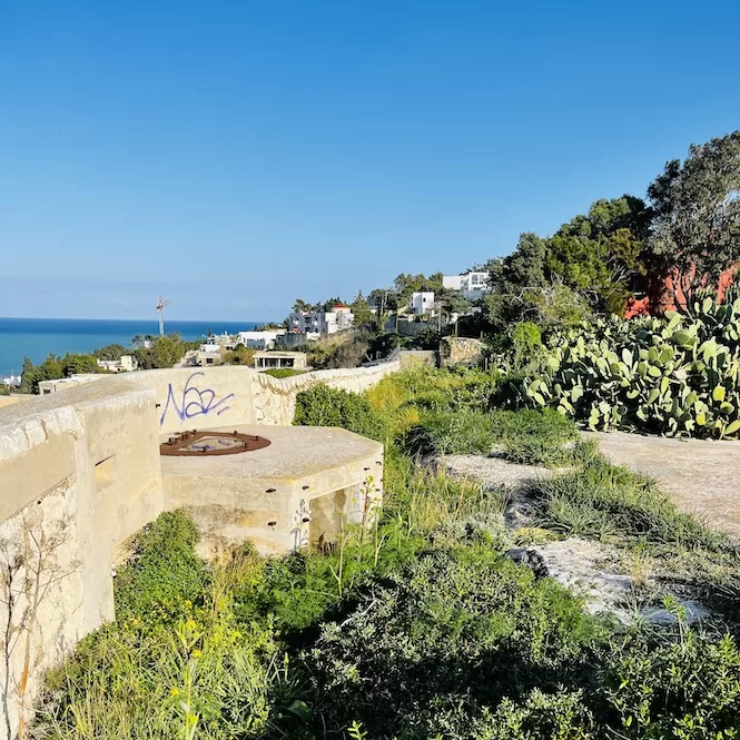
The wall of the Victoria Lines starts from the battery. So you can start your hike from here instead of Fort Madliena. There is a small parking lot nearby, but it is limited.
You can follow the wall using a narrow path. Sometimes it is overgrown. It gives you the impression that you are in the jungle. However, you will soon see a stone bridge over the Wied il-Faham Valley between Gharghur and Madliena. This part of Victoria Line is similar to the Bingemma Gap wall but even less busy.
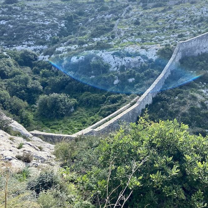
Once you cross the bridge, a steep path will lead you to the Top Of The World in Għargħur. So many people come here for sunsets and views of the island. It’s a popular spot for locals, and while it’s simple, the views are rewarding.
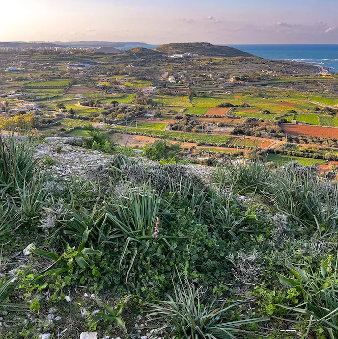
The Top of The World in Gharghur to Naxxar
After walking along the paved path for maybe 10-15 minutes, you’ll see another valley called Wied Anglu. This valley is also quite picturesque.
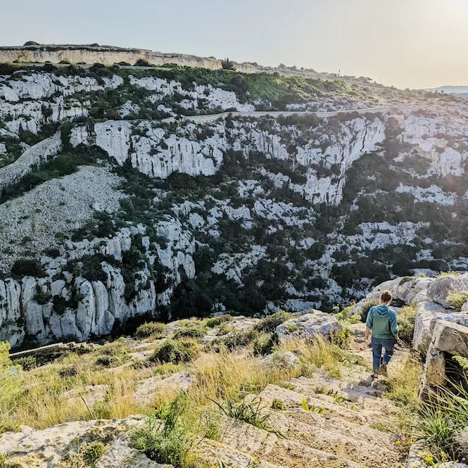
Continuing along a wall for five to ten minutes after crossing the Wied Anglu Valley, you will hear cars passing by. On your left, you will see Triq John Adye Road. From this point on, your wall will not be visible. Unfortunately, it has been destroyed, so if you want to continue walking to the west, you should reach Mosta Bride Garden.
It would be best to take a taxi or a bus to Mosta. Otherwise, you will have to walk along a busy, polluted road. Bus 103 goes from the Birguma bus stop to Mcast Mosta. If you prefer walking, just go toward the MCAST Mosta campus.
If you like hiking and nature, you’ll love the Victoria Lines trail. The walk offers breathtaking views and a chance to learn about the island’s history. This blog gives you the accurate information you need about the Victoria Lines walking trail.
Thank you for reading, and please check out my other treks in Malta.
- A walk from Busket to Dingli Cliffs
- Circular Selmun Palace Hike
- Paradise Bay Loop Hike
- The Cliffs Hike on the West Side of Malta
- A Hike in Malta’s South: from St. Thomas Bay to St. Peter’s Pool
- Wied Babu Hike
- Majjistral Park Walk
- Hike from Ghajn Tuffieha to Gnejna Bay
- Walk from Ancient Temples to Ghar Lapsi
If you plan to visit Gozo, here is a list of the best Gozo’s coastal walks.
Victoria Lines Malta: FAQ
Why were the Victoria Lines built?
The Victoria Lines were constructed by the British military in 1897 as a defensive fortification system. Their primary purpose was to protect the strategic Grand Harbour area from potential invasions from Malta’s northern part. This fortification was a symbol of military strength and strategic defence during Queen Victoria’s Diamond Jubilee.
How long are the Victoria Lines?
Stretching across Malta, the Victoria Lines span a length of over 14 kilometres. This extensive system includes various military structures such as forts, batteries, and entrenchments.
What forts are part of the Victoria Lines?
The Victoria Lines consist of several key forts:
- Fort Bingemma: Built between 1875 and 1878, initially armed with guns for northern Malta and later used for military training and communications.
- Fort Mosta: Known for its pentagonal shape and battery, currently serves as an ammunition depot for the Armed Forces of Malta and is not open to the public.
- Fort Madliena: Built in the 19th century, it is elevated at 132 meters and houses large guns. Today, it is utilised for rescue training by St John Rescue Corps Malta.
Who built the Victoria Lines in Malta?
British military built Victoria Lines as part of their strategic defence plan for Malta. The construction reflected the British military’s commitment to protecting their territories and interests during the late 19th century.
Why is it called the Victoria Lines?
The Victoria Lines were named in honour of Queen Victoria’s Diamond Jubilee, celebrating her 60th year on the throne. This name was a tribute to Queen Victoria and her reign, reflecting the significance of the British monarchy at the time.

