Just a quick heads up – some of the links I share on this site are affiliate links. That means if you click on one and make a purchase, I may earn a small commission at no extra cost to you. Your support through these links helps me create valuable content.
Malta is famous for its stunning beaches, rich history, and cultural heritage. It is a popular tourist destination, but there are so many hidden gems in Malta that are often overlooked.
I’ve lived in Malta since 2011. My passion for history, culture and nature has led me to its best secret spots. I’m here to share these with you.
Tourists usually follow the most popular paths and miss these hidden places. But Malta’s real charm is in quiet, secluded places, small villages and nature spots. They offer unique experiences, far from the crowds.
This post is for you if you’re looking for something different, not just typical tourist stuff. It guides you to Malta’s undiscovered parts.
Ready for what’s ahead? Let’s explore 8 Malta’s hidden gems together.
Getting Around
Public transportation makes it easy to see the popular spots, like Valletta and the Three Cities. But reaching the hidden gems is a challenge.
I’ll tell you how to drive and take public transit to each hidden site, but I recommend renting a car.
Need advice on renting a car in Malta? Here’s my guide with insider tips on everything you need to know.
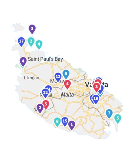
Map of Hidden Gems in Malta
The following map shows all the hidden gems marked with their names. Hover over any pin to see the location’s name.
Malta’s Hidden Gems: Red Tower and the Surrounding Area
Many watch towers are scattered around Malta, but none compare to St. Agatha’s Tower, also called The Red Tower. It is a 17th-century fortification located on the north coast of Malta. It’s a secret spot that’s must to be seen.
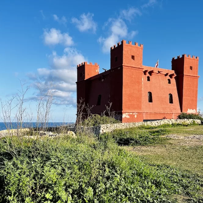
This tower has a panoramic view of Ghadira Bay and the sea between Comino and Gozo. It had a clear view of any foreign boats entering Mellieha Bay.
From the tower, you can see other watchtowers and maintain contact between Gozo, Comino, and Mdina. You can see Santa Marija Tower in Comino and the Comino Battery. Also visible from the roof are the White Tower at L-Armier and Lippija Tower above Ġnejna Bay.
Both the tower and the surrounding area are impressive. The views are panoramic, and you can see both the west and east sides of the Mediterranean Sea.
It’s best to walk for 10 minutes to the west side till you reach this viewpoint. You will enjoy a stunning panorama with views of Majjistral Park, the Golden Bay rocks, and Fomm ir-Riħ.
There is a feeling that you can see half the island from here, as this is one of the highest points above sea level in Malta.
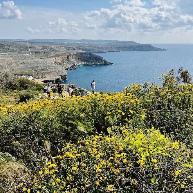
There are small stairs leading down the hill. If you walk all the way to the cliff’s edge, you’ll be treated to amazing views. These fields are green in winter and spring. There are also small fig trees scattered along the paths.
This area is also good for hiking from Paradise Bay. Check out this guide. That’s one of my favourite hikes, so I highly recommend it.
Getting to the Red Tower:
- Location: link to Google Maps
- Nearest bus stop: Qammieh
- Walking distance from the bus stop: 600 m
- Frequency of the buses: you can catch a bus every 15 minutes or so
- Parking available: public parking along the road
Limestone Arch and Cliffs at the Munxar Point in Marsaskala
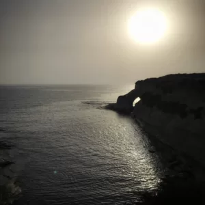
In St Thomas Bay of Marsaskala, you can find a stunning limestone arch at Munxar Point. A limestone arch is a natural geological formation formed when water erodes the rock and creates an arch shape.
Munxar Arch has a curved shape and a pale, smooth colour. It looks incredibly picturesque, surrounded by turquoise seawater and greenery.
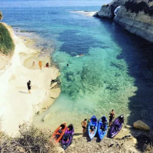
A shallow bay lies in front of the arch. There are ladders around to allow people to swim. Thus, it’s a great area to swim and snorkel. The arch can be swum through in calm waters.
When you have admired the Munxar Arch, climb up for about 200 meters to the viewpoint of white limestone cliffs.
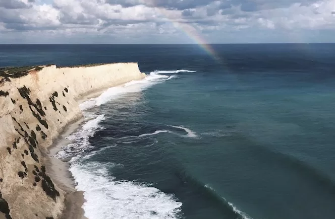
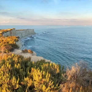
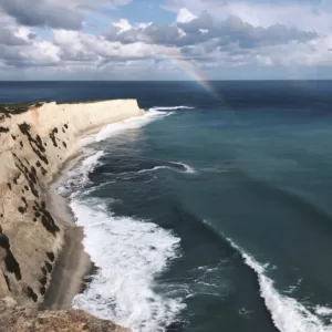
There are tall and steep cliffs, but they are lighter than in other parts of Malta. The pale limestone rock creates a striking visual contrast with the crystal-clear blue waters below the cliffs. The waters below the cliffs are shallow.
Depending on the weather and time of day, they appear turquoise or green. The following two images show the exact location but look so different.
You can’t walk down the cliffs, but you can watch the cliffs from the top. Also, you can paddle board or kayak closer to the cliffs. Book a kayaking adventure here.
If you like hiking, you will enjoy a hike from St. Thomas Bay to St Peter’s Pool.
Getting to the Munxar Point:
- Location: link to Google Maps
- Nearest bus stop: Bajja
- Walking distance from the bus stop: 1.3 km
- Frequency of the buses: every 30 minutes
- Parking available: on-street is available around 600 meters away
Hidden Gems in Malta: Dwejra Lines
The next hidden gem in Malta are Dwejra Lines that form part of Victoria Lines.
Finished in 1897, the Maltese Victoria Lines were built by the British in honour of Queen Victoria’s Diamond Jubilee.
While never tested in battle, this fortification stretches over 12 km and combines forts, batteries and defensive walls.
Victoria Lines follow a natural barrier. The barrier makes the northern part of the island lower in altitude. Victoria Lines start from Madliena in the east, go through Mosta and finish in Binġemma on the west coast.
Dwejra Lines is one of the most picturesque sections of Victoria Lines. You can walk down the lines for some pics. You can also explore caves off the beaten path.
However, there are only a few signs on the Victoria Lines. Plans are to put up signs and boards explaining the history of this historical site.
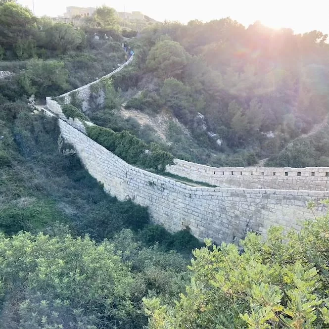
Getting to Dwejra Lines:
- Location: link to Google Maps
- Nearest bus stop: Santi
- Walking distance from the bus stop: 800 m
- Frequency of the buses: buses run once an hour or less
- Parking available: some spots are available on the road
Get a FREE Attractions Map
Planning a trip to Malta, Gozo, or Comino? Get this free interactive map filled with insider tips, Google Maps links, and more.
Hagar Qim and Mnajdra Surroundings
Hagar Qim and Mnajdra were temples built between 4000 and 3200 BC. They served religious purposes and as community gathering places.
The Hagar Qim and Mnajdra Temples draw a lot of tourists, but many people don’t wander further. The surrounding area of these temples is a true hidden gem in Malta.
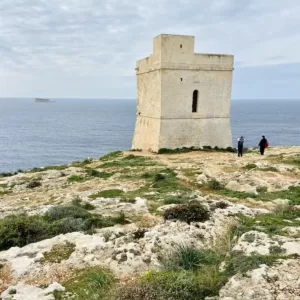
I suggest you walk from Hagar Qim to Tal-Hamrija Coastal Tower. The path leading to the tower is marked. The Tal-Hamrija Coastal Tower is a former defensive tower with a well-preserved exterior. Unfortunately, it is not open to the public.
From the tower, you can see Filfla. Filfla is a small, uninhabited island with a barren, rocky landscape about 4.5 km from Malta. With a coastline of 988 metres, Filfla is surrounded by 60-metre-high cliffs. It has been recognised as an Important Bird Area. Visitors must get permission before visiting the island.
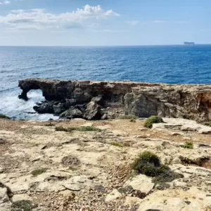
It is also possible to see a natural limestone arch from the tower. It’s called Ghar Hanex Window. The contrast with the greenery, orange rocks, and blue water makes it look stunning.
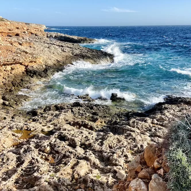
If you want to explore the rocks further down, look for red spots. They will show the easiest route. Watch your footing to avoid tripping. Enjoy the sound of the sea and the sight of waves crashing against the shore when you get to the water.
Getting to Hagar Qim Temples:
- Location: link to Google Maps
- Nearest bus stop: Hagar
- Walking distance from the bus stop: 350 m
- Frequency of the buses: every 30 minutes
- Parking available: parking is available at the Hagar Qim Visitor’s Center
Hidden Gems in Malta: Coral Lagoon
Coral Lagoon is a natural sea pool in Malta’s north. This is a must-see destination for adventurers, nature lovers, and photographers. It is located between cliffs and connected to the open sea via a tunnel. It offers beautiful views of the sea and Comino Island.
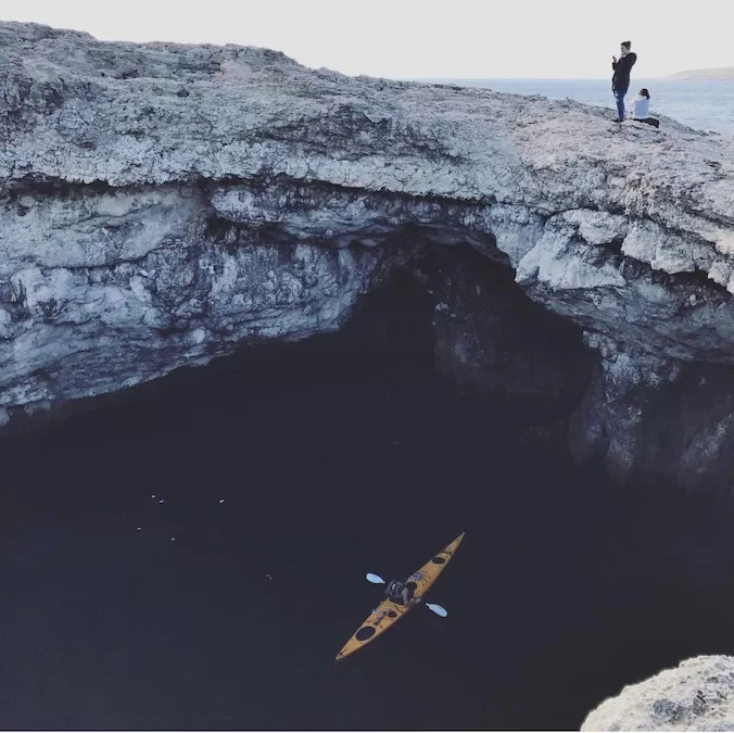
You can discover its hidden corners and unique viewpoints by renting a kayak at Tortuga Beach. Here you can enjoy a refreshing swim or snorkel, with colourful fish and sea urchins to see.
During winter, nature enthusiasts can enjoy the area’s raw beauty by hiking around it. Find my complete guide to the Coral Lagoon here.
Getting to Coral Lagoon:
- Location: link to Google Maps
- Nearest bus stop: Xmajjar
- Walking distance from the bus stop: 2.30 km, 30 minutes
- Parking available: free parking on the road next to the camping
The Gorge in Miġra l-Ferħa Area
This gorge is easily accessible from Miġra l-Ferħa. The gorge was created by water erosion. There are old stairs that lead to the sea. At the end of the gorge, the water is deep, and depending on the weather, there may be rough waves crashing against the rocks.
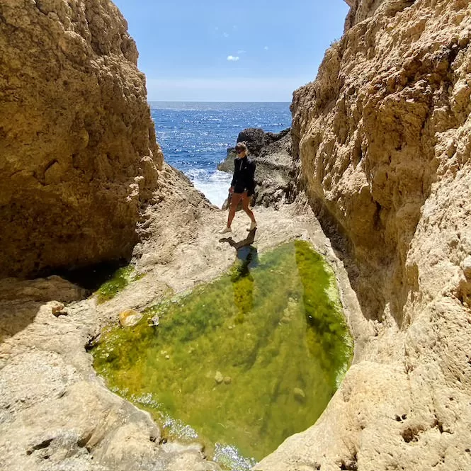
You can also walk around Miġra l-Ferħa. There are amazing views of the cliffs and the sea from here. There aren’t too many people here, which I absolutely love.
You can watch sunsets here, or have a picnic and relax. Here’s one of my favourite cliffs among the many offered in Malta.
Getting to Miġra l-Ferħa:
- Location: link to Google Maps
- Buses: no buses are going to this area
- Parking available: ample parking available here here
Hidden Gems in Malta: Wied Babu
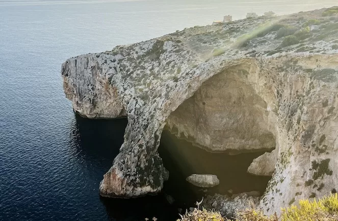
Wied Babu is near Zurrieq and the Blue Grotto. It is a valley rich in greenery with stunning sea views. Ideal for nature enthusiasts.
The trek to Wied Babu is 1 km long and takes around 60 minutes to complete. The path features a climbing area, leading to a picturesque blue pool by the sea, suitable for swimming.
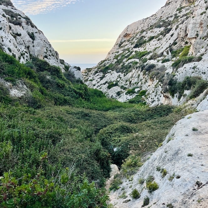
To navigate the valley safely, sturdy trekking shoes and long trousers are essential. The trail includes narrow paths surrounded by sharp bushes.
The terrain is rocky and uneven, requiring some climbing. Due to its challenging nature, this trek might not be suitable for children or the elderly.
The adventure begins near the Blue Grotto (see details below). From there, walk 500 meters towards Zurrieq to locate a metal ladder. This ladder marks the starting point of your Wied Babu hike.
Getting to Wied Babu:
-
- Location: link to Google Maps
- Nearest bus stop: Grotto
- Frequency of the buses: every hour.
- Parking available: in the car park here
Xemxija Heritage Trail
The Xemxija Heritage Trail in Malta offers a glimpse into the island’s rich past.
A unique feature of the trail are the ancient apiaries, a testament to Malta’s long history of beekeeping. These structures are both artistic and functional, reflecting the island’s ancient honey making ties.
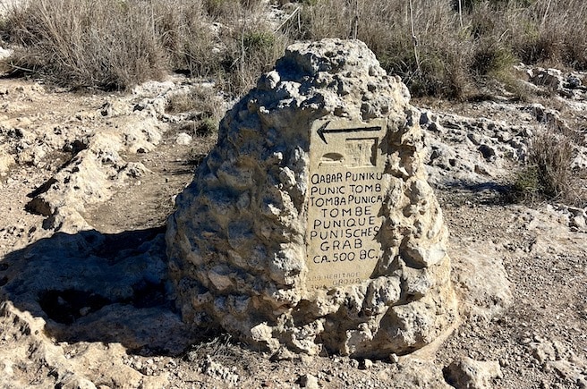
There’s also a centuries-old Carob tree, known for its variety of uses. Also on the trail you will see the Punic Tomb and Neolithic Tombs.
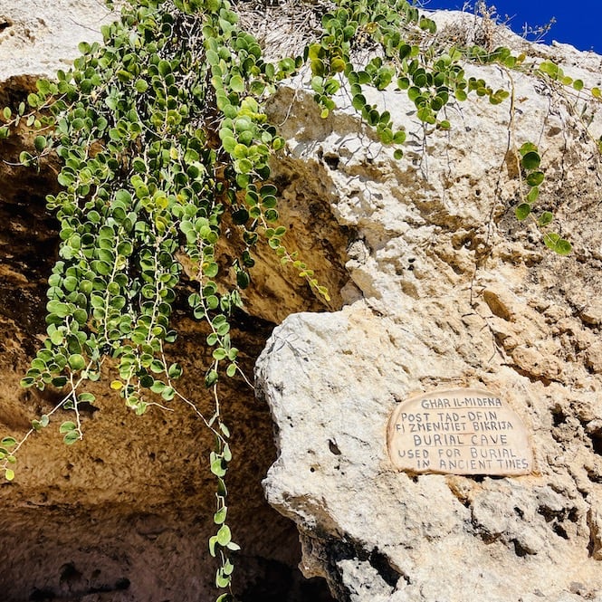
Besides being historical, the Xemxija Heritage Trail is quiet and pretty. It winds through scenic landscapes, providing a peaceful escape from the crowds.
It’s easy to get to, with bus stops nearby, and gives you a gorgeous view of Xemxija and St. Paul’s Bay. There are hills on the pathway, so it’s not suitable for those with mobility issues. It’s not adapted for wheelchairs or pushchairs either.
Getting to Xemxija Heritage Walk:
- Location: link to Google Maps
- Nearest bus stop: Roti in Xemxija, St. Paul’s Bay
- Walking distance from the bus stop: 5 minutes
- Parking available: Street parking.
Despite being a small island nation, there are so many hidden gems in Malta you can explore. If you’ve already seen all the top sights or want to avoid crowds, don’t miss these hidden gems in Malta. I’m sure you’ll like them.
Also, check out my guides to beaches and hiking in Malta and Gozo.
Have questions about your Malta trip? Join my FREE private Facebook group, Malta Travel Tips, where you can find helpful resources and connect with fellow travellers!

