Just a quick heads up – some of the links I share on this site are affiliate links. That means if you click on one and make a purchase, I may earn a small commission at no extra cost to you. Your support through these links helps me create valuable content.
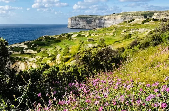
Are you looking for a scenic Gozo hiking trail? The trail from Mgarr Harbour to Xlendi is perfect. It has stunning clay slopes, pretty salt pans, and terraced fields. It’s a feast for your eyes. You’ll walk past Mgarr ix-Xini, a lovely inlet. The Sanap Cliffs will amaze you with their breathtaking views of Malta and Comino.
I moved to Malta in 2011. I’ve hiked all around Gozo and I know its coastal hikes well. This trail is my favourite. It’s great for both experienced hikers and nature lovers. Plus, it never gets boring, no matter how often you walk it.
I will share all the information you need to fully enjoy this amazing Gozo hiking trail. I’ll tell you about hidden spots and the best times to visit. You’ll get insider tips to make your hike unforgettable. Come along and experience Gozo’s natural beauty like never before!
- Distance: 12,1 km
- Walking Time: 3 h 20 mins
- Level: Advanced
- Uphill: 200 m
- Downhill: 200 m
- Highest Point: 140 m
The best time to go: anytime, but try to avoid the midday heat from June to September.
To jump to different sections, here is a table of contents.
A Map – Gozo Hiking from Mgarr Harbour to Xlendi
Getting Ready for a Hike
Be prepared with the right gear when doing the Mgarr to Xlendi walk. Make sure you wear comfortable shoes. Bring a hat and sunscreen in the summer, and layer up in the winter. If you’re hiking in the summer, bring your swimsuit, because there will be places to dip into the sea.
A full water bottle and snacks are recommended for your hike. You should also bring an offline map, a first-aid kit, and a charged cell phone. Food and drinks are available from restaurants in Mgarr ix-Xini, but they might be closed in winter.
Xlendi, at the end of the hike, has many restaurants where you can have lunch. The hike might take 5 hours, including breaks. So, it might be more sensible to bring your own food and picnic along the way in Xlendi.
Getting to Mgar Harbour, the Hike’s Starting Point
If you’re in Malta, you’ve got to go to Gozo first. There are two ways to get there: from the Ċirkewwa ferry terminal or the Valletta terminal.
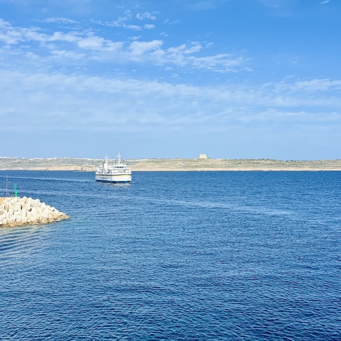
The Ċirkewwa ferry terminal is the northernmost point on Malta. From Ċirkewwa, you can take the Gozo ferry, which transports cars and foot passengers. The ferry ride takes about 30 minutes. Check out its schedule here.
Here’s a warning! People from Gozo work in Malta during the week, and some Maltese have weekend homes in Gozo. So, there’s a lot of traffic on Friday afternoons driving to Gozo and on Sunday evenings heading to Malta. Avoid these times if you can.
Ċirkewwa is accessible by public transport. Several buses connect Malta’s main tourist spots with the ferry terminal. There’s a bus stop right next to the terminal.
Need advice on renting a car in Malta? Here’s my guide with insider tips on everything you need to know.
You can also take the Fast Ferries from Valletta to Mgarr Harbour in Gozo. This is available to foot passengers. You can find the latest fares and timetables on this website. I usually take these fast ferries on Fridays and Sundays to avoid traffic.
Once you get to Mgarr Harbour, head to the end of the small parking lot near the ferry terminal. Here is the location. Usually, there are a few other hikers out there, and you can see the trail.
Mgarr Harbour to Xatt L-Ahmar
Mgarr Harbour to Xatt L-Ahmar is the first part of the hike. You should be done in 25 minutes.
There’s a beautiful secluded rocky beach called Gorgun just a minute away from the starting point. The beach is small and quiet. It is a picturesque place to swim or relax and enjoy the beach with views of Malta.
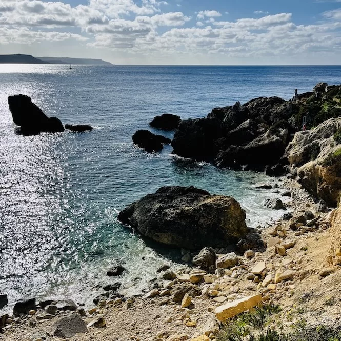
Keep walking until you reach a bay surrounded by clay slopes. There are two options here. It’s either walk down to the water’s edge or go up towards Fort Chambray and walk down later.
I usually hike along the water. Make sure you don’t slip on the way down. It can also get muddy after rain.
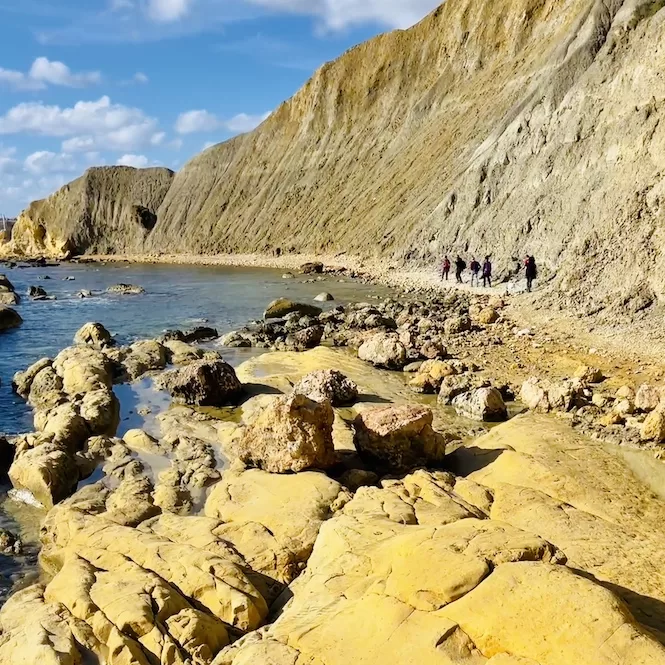
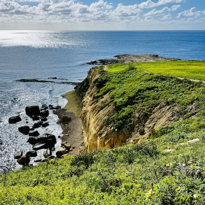
Take a look at the clay cliffs and the colour of different layers. It looks red at the top. That’s probably why the next bay is called Xatt l-Aħmar, which means Red Reach in Maltese.
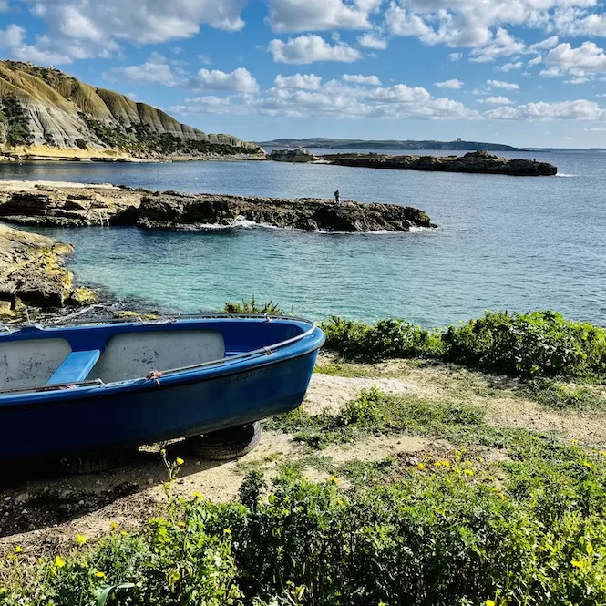
Once you pass the clay slopes, you will end up in Xatt l-Aħmar Bay. You can’t beat this bay for peace and crystal clear waters. Plus, it’s never crowded here.
There are some boathouses, and sometimes I see fishermen getting their boats ready. Visit this post about the best secret beaches in Malta to learn more about Xatt l-Aħmar Beach.
How about staying in Gozo in a villa with a private pool? Discover your dream spot with my guide to the best villas for every budget.
Xatt L-Ahmar to Mgarr Ix-Xini
As you follow the path, you’ll pass fields. There will be a gradual climb. There’s a lot of greenery and flowers in winter.
After 25 minutes, you can turn left, walk along the cliff edge, or continue straight. Follow the red arrow painted on the well and go down. By walking straight, you might get to the same place. I prefer to hike along the water, so I did not take the other route.
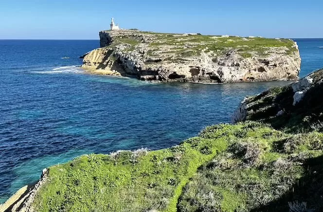
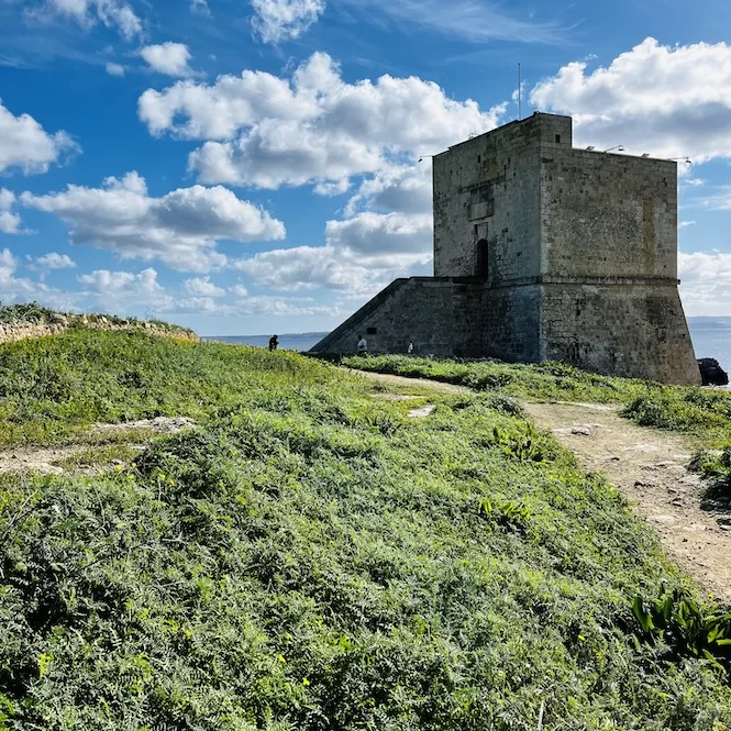
After a few minutes, you’ll see a watch tower. Mgarr ix-Xini Tower is one of four coastal watchtowers that still stand on Gozo. It is the biggest coastal watchtower, the Knights of Malta, built on Gozo. It watches over the entrance to the bay of Mgarr ix-Xini. The tower was completed in 1661.
From the tower, walk along the path that leads you inland. There are incredible views there. Towards the end of the bay, there are small stairs that lead down to the valley.
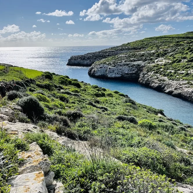
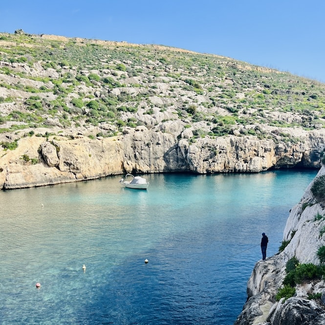
The scenic Mgarr Ix-Xini Bay is in a natural valley surrounded by steep cliffs. At the bottom of the water, there’s sand, making the water look turquoise. Take a break here and enjoy the scenery. A refreshing swim is also enjoyable here.
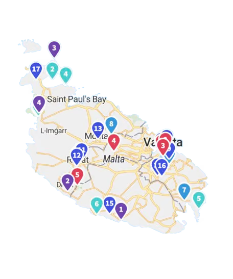
Get a FREE Attractions Map
Planning a trip to Malta, Gozo, or Comino? Get this free interactive map filled with insider tips, Google Maps links, and more.
Mgarr ix-Xini to Sannat Cliffs
Take a walk across the bay to the picnic tables. There’s a small path that leads uphill. Keep walking up until you hit a small road.
From there, it’s a gradual uphill walk for about 20 minutes. From time to time, turn around to see Mgarr Ix Xini from afar. You’ll see how small the tower is when you’re up there.
Soon, the map will lead you away from the cliff edge. The waterside is private, so we must trek through the Ta’ Ċenċ village. Google Maps also shows an alternative path. Make sure it leads to the Sannat Cliffs.
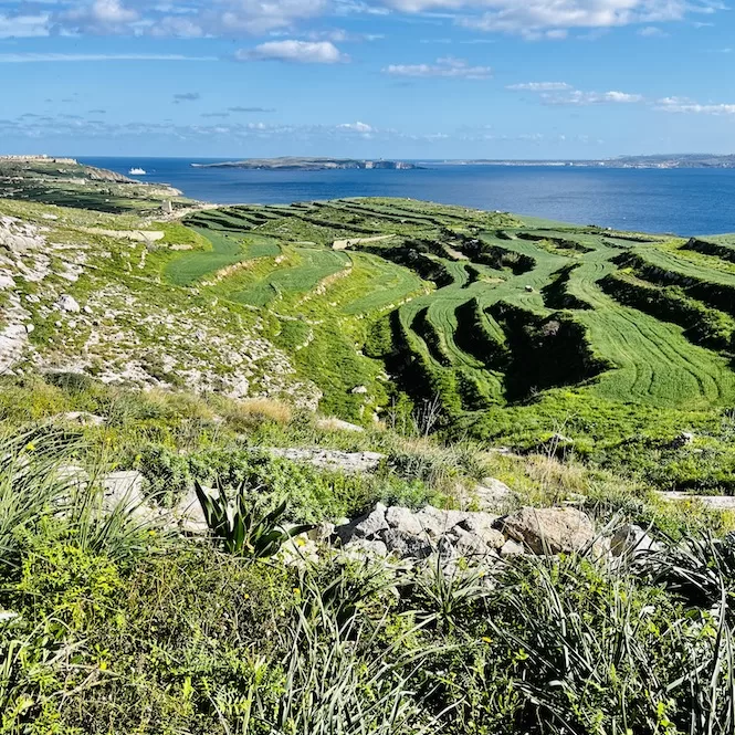
Once you arrive at this location, you must cross private land to end up next to the cliffs. You can pass there, but stay quiet and respectful.
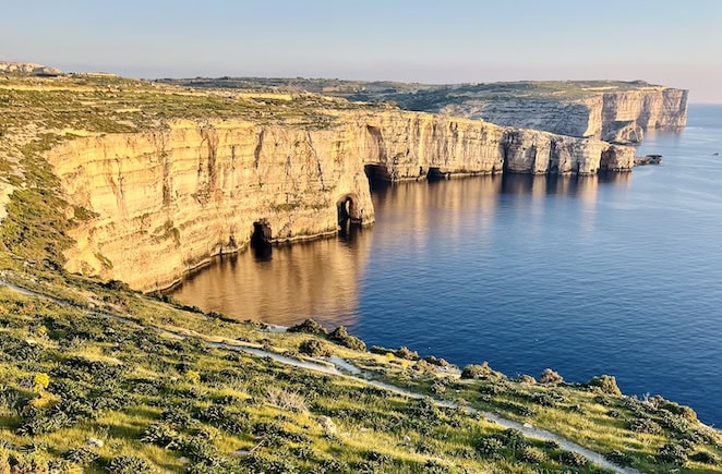
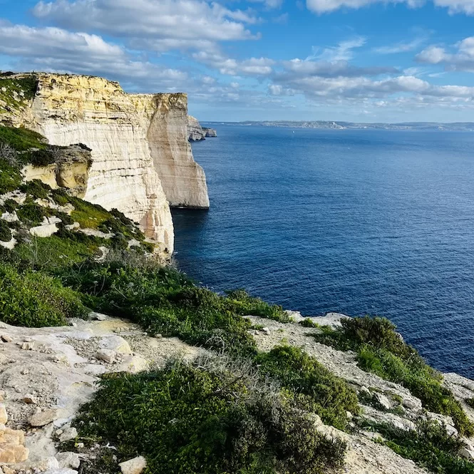
The cliffs are breathtaking. They plunge vertically into the deep Mediterranean sea. It’s the perfect way to soak up the ocean’s vastness. They’re nearly impossible to describe with photos. You’ve got to see them. It’s truly a memorable experience.
Xlendi – The End Point of this Gozo Hiking Trail
Continuing the hike until you finish is easy. Just follow the cliff’s edge. You’ll see benches on the sides of a paved path after 10 minutes. That’s a relief for tired legs.
Sanap Cliffs, one of the highest points on the coast, are located here. This is a popular scenic walk, especially at sunset. Watching birds is great here too.
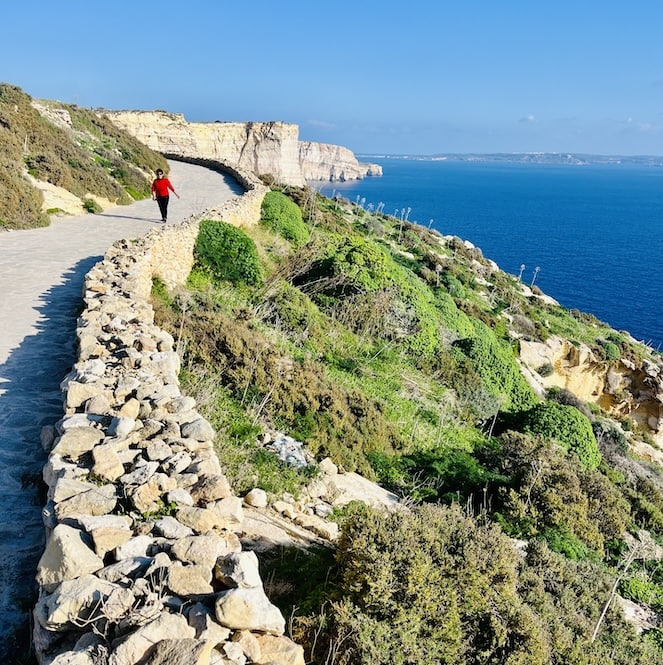
You will soon reach the end of the paved path. Take the hiking trail along the seaside. There are a few paths. Just follow the seaside path. The path will gradually descend. Soon you will see Xlendi Tower in the distance.
The Xlendi Tower is the oldest watchtower on Gozo. One of the Lascaris towers dates back to 1650; it’s being restored right now.
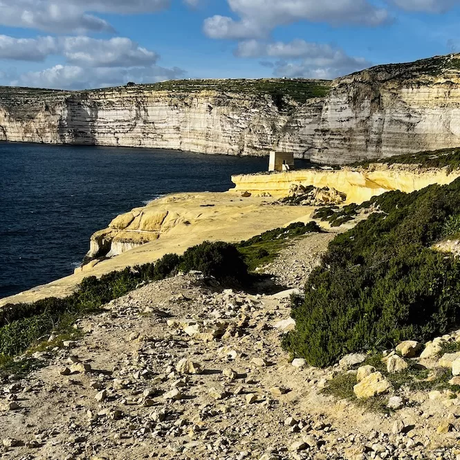
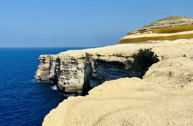
Walk along the yellow limestone coast to get to the tower. This area is awesome. I love how the yellow limestone contrasts with the blue ocean and vertical cliffs.
From the tower, turn right. You’ll see a path winding down. Cross the small bridge over the valley, and you’re on Xlendi‘s promenade.
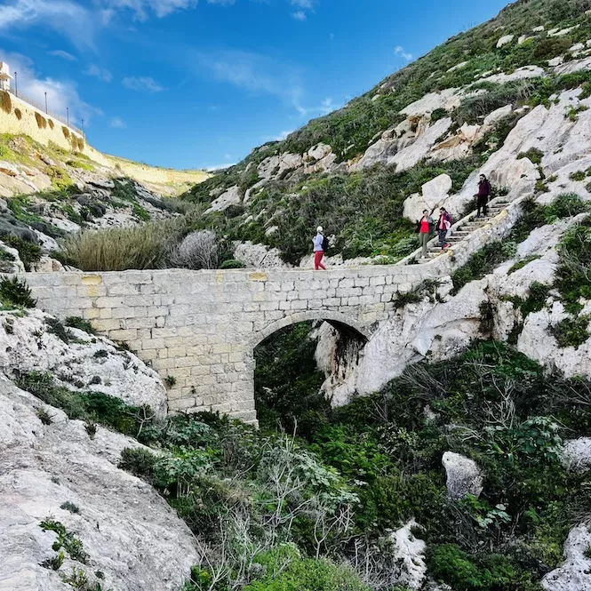
On the promenade, there are picnic tables and benches there. Sunsets are popular here. This bay is also suitable for swimming. They can leave their stuff on the benches and jump into the sea. There are ladders available for swimmers to get out of the water.
Both tourists and the Maltese love Xlendi. There are a lot of restaurants, cafes, kayak rental services, and diving centres. It’s a great place to end a hike with a Mediterranean meal.
The hike from Mgarr Harbour to Xlendi is a must-do for nature lovers visiting Gozo. There are stunning views of the coast and natural spots to explore on the trail.
If you’re looking for more hikes in Gozo, check out my trekking guides from Mgarr Harbour to Hondoq Bay, Xwejni to Ghasri Valley or Ghasri Valley to Wied il Mielah. In Malta, I recommend hiking around the Selmun area, taking a cliff-side walk or a hike in Paradise Bay. These hikes offer unique experiences and the chance to explore Malta’s diverse landscapes and culture.
Apart from hiking, there are some amazing things to do in Gozo that you can’t miss, like quad biking, jeep tour or kayaking between Gozo and Comino.
Have questions about your Malta trip? Join my FREE private Facebook group, Malta Travel Tips, where you can find helpful resources and connect with fellow travellers!

