Just a quick heads up – some of the links I share on this site are affiliate links. That means if you click on one and make a purchase, I may earn a small commission at no extra cost to you. Your support through these links helps me create valuable content.
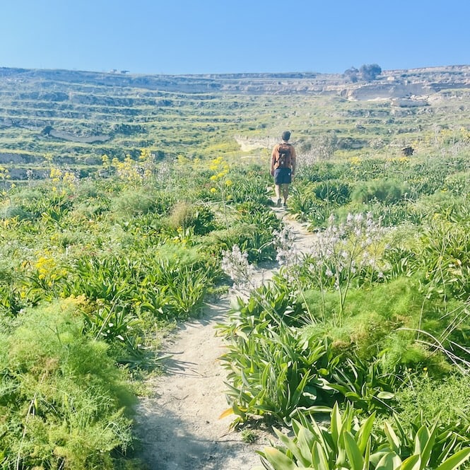
Gozo is a small island that’s part of Malta. It’s known for its stunning coastline that stretches for about 55 kilometers. And guess what? You can go on an epic hike around Gozo and explore its cliffs, hidden beaches, and seaside villages.
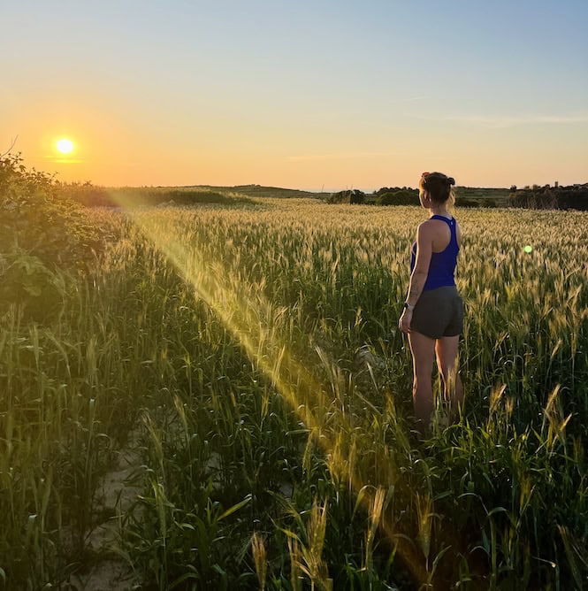
I’ve done this multi-day hike twice now. Most recently, I did it in the spring of 2025, and the weather was perfect – not too hot, not too cold, and with plenty of sunshine to light the way.
The hike is about 50 km long, because some stretches of the coast are not accessible by foot. Now, I won’t sugarcoat it – the hike around Gozo is not easy. It’s a tough trek that requires a decent level of fitness.
In this guide, I’ll provide you with a detailed map of the hike, broken down into different sections. I’ll also recommend some great places to stay along the way, so you can rest and recharge after a long day of walking.
And if you’re not sure you can tackle the full 50-kilometer hike? No problem! I’ll also highlight some of the best sections of the hike that you can do in half a day or a little longer. That way, you can still experience the beauty of Gozo’s coastline without committing to the full trek.

Written by Laura Jasenaite, Malta travel expert with 15+ years living on the islands.
Planning Your Around Gozo Hike
Best Time of Year for the Hike
The best time to embark on this multi-day hike in Gozo is between November and April.
You can hike year-round, but the summer months can be very hot. And, the land may look dry and yellow.
For the best views, consider hiking from February to April. The island is in bloom then. You’ll see a colourful display of flowers.
When hiking between November and April, it’s essential to pack a rain jacket and a windbreaker. The weather can be unpredictable.
Hiking in March or April? Some days are warm. So, pack a swimsuit and towel for a swim. Nothing beats a quick dip in cool water.
What to Pack for Your Hike
This hike doesn’t need much planning. But, you need to be fit. If you hike or walk regularly, you should be able to complete the trek without any problems.
The elevation gain is around 1000 meters throughout the entire hike. It’s not that little but it’s not as challenging as hiking up a mountain.
To ensure a comfortable and safe hike, wear sturdy hiking shoes. Some sections of the path can be uneven and rocky, and good footwear will help prevent foot fatigue and reduce the risk of injury. Additionally, pack sunblock, a cap, and a swimsuit.
Along the way there will be some places where you can get water and snacks. But, it’s safer to have enough water and some energy bars.
If you are coming from Malta, your first day might start later. For a two-day trip, pack lunch for day one. You’ll walk over 25 km, so stopping at a restaurant would take too long. Instead, pack a sandwich or buy something on your way to Gozo.
Safety Considerations
During the hike, you will walk along tall, picturesque cliffs that offer stunning views. While it’s tempting to take photos, exercise caution and avoid getting too close to the edge to prevent falling.
Also, be mindful of any visible cracks or unstable rocks near the cliff’s edge, and maintain a safe distance.
Also, it’s good to tell someone about your hiking plans. Carry a charged phone and pack water, snacks, and a basic first aid kit.
In case of an emergency or if you find yourself in trouble during the hike, dial 112 for help.
Where to Stay during the Gozo hike?
Accommodation Options for a Two-Day Hike
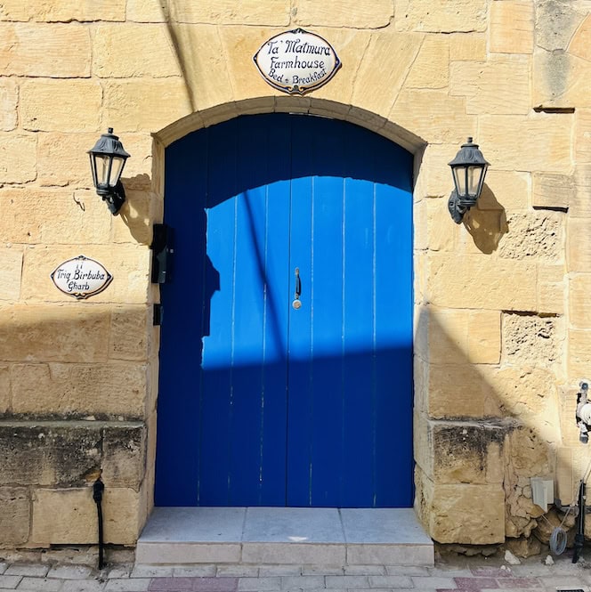
If you plan to complete the Gozo coastal hike in two days, I recommend staying in Gharb for the night, as it’s the closest point to your route. This way, you won’t have to walk far from your route to reach your accommodation and then walk back to continue the hike the next day.
We stayed in a charming Ta’ Matmura Farmouse in Gharb.
If there’s no availability in Gharb, you can consider staying in nearby villages like San Lawrenz, Zebbug or Għasri.
In this case, you might want to take a taxi from where you stop hiking to your accommodation. Then, you can take one back to the starting point the next day. Taxis are generally affordable, especially if you’re sharing the cost with others.
Get a FREE Attractions Map
Planning a trip to Malta, Gozo, or Comino? Get this free interactive map filled with insider tips, Google Maps links, and more.
Accommodation Options for a Three-Day Hike
For those embarking on a three-day hike, plan your route to end the first day in Dwejra Bay and stay in San Lawrenz for the night.
San Lawrenz is a peaceful village located approximately 15 to 20 minutes walking distance from Dwejra Bay. If you prefer not to walk, you have the option to take a bus or a taxi.
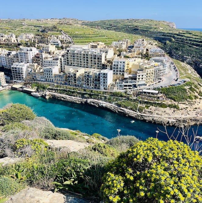
For your second night, Marsalforn is a great choice. This town offers a variety of accommodation options.
Unless you plan to hike during peak holidays like Christmas, Easter or summer months, there’s no need to book far in advance. I usually book my accommodation a week or so before.
Route Description and Sections
The around Gozo hike starts at Mġarr Harbor, and I recommend going clockwise.
Along the way, you’ll pass through different villages, and the first half of the hike will mainly take you along high cliffs.
The second part of the hike, from the north, will lead you through various bays. There is a little more climbing as you’ll need to go up and down into the bays. But, it’s equally stunning.
Want to plan your whole Malta trip without the stress?
My 7-Day Malta Itinerary handles the routes, timings, and where to start, so you can just be there. Less planning. More Malta.
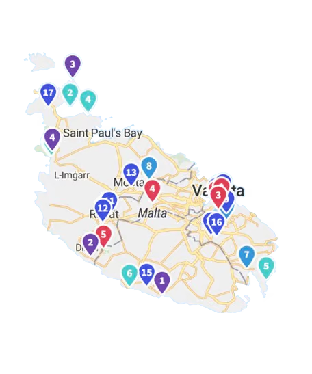
Hiking Map
Here’s a hiking map with the route and viewpoints marked. You can download the Komoot app to use this map for your hike. It’s a great tool to have as some sections can be a bit tricky to navigate.
Route Sections
The hike can be divided into several sections:
Mġarr Harbor to Xlendi: This is a beautiful section that can be completed in about four hours, with stops for lunch. I often do this part when I visit Gozo for a day.
Xlendi to Dwejra: In this section, you’ll walk mainly on high cliffs, offering breathtaking views.
Dwejra to Wied il-Mielaħ: This part is a bit more challenging, as there are some areas where the path is not very clear. But use the map I provided and you won’t get lost.
Wied il-Mielaħ to Għasri Valley: You’ll walk along the cliffs and see some sea caves. You’ll end in a valley with a small pebble beach that looks like a canyon.
Għasri Valley to Marsalforn: From Għasri, you’ll head to Marsalforn, going through Gozo salt pans.
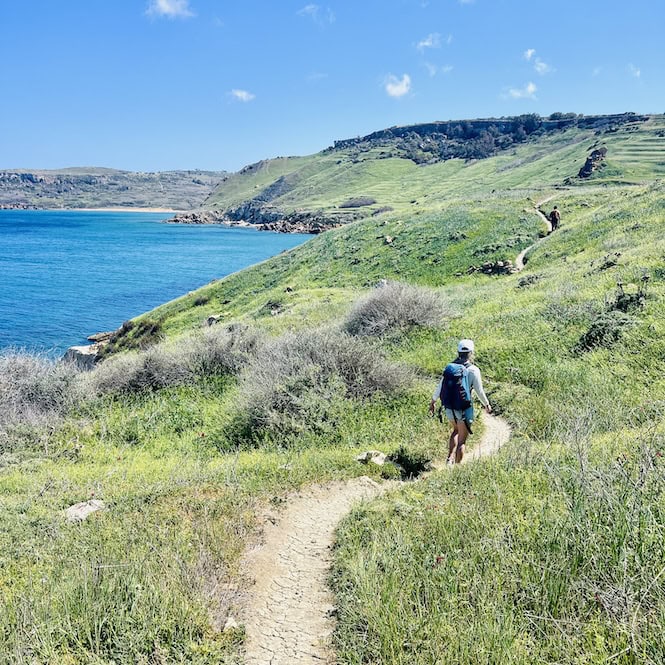
Marsalforn to Ramla Beach: You will walk up and down, crossing smaller bays. This section is the hike’s greenest.
Ramla Beach to San Blas: In this section, the path doesn’t always follow the coast, so you’ll need to go a bit inland and walk on village roads. Still, it’s pleasant to walk on the small streets because you’ll avoid the main roads.
San Blas to Hondoq Bay: From San Blas, follow a steep road to Nadur, then turn left to reach Daħlet Qorrot Beach along the coastline. From there follow the coastline via St. Anthony’s Battery till you reach Hondoq Bay.
Hondoq Bay to Mġarr Harbor: The final section is quite short, around 3 km, and you’ll walk along the coast with stunning views of Comino.
In total, this is a challenging 50 km trek. Some people complete it over three days, while others do it in two. During my last visit, we tackled it as a two-day hike. Yet, taking three allows for more time and longer breaks, making it a bit more relaxed.
Join my FREE private Facebook group, Malta Travel Tips, where you’ll find helpful resources and connect with other travellers just like you!
Detailed Route Description
Mġarr Harbor to Xlendi
The hike starts at Mġarr Harbour, Gozo’s main entry point. It leads you along a scenic coastal path. You’ll pass Xatt l-Aħmar Bay. Locals love this bay. It’s popular because of its clear waters and peaceful surroundings.
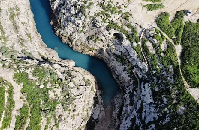
As you continue, you’ll encounter the Mġarr ix-Xini Tower, a 17th-century coastal watchtower built by the Knights of Malta.
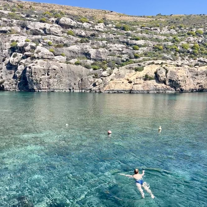
The trail then leads you to the Mġarr ix-Xini Bay, located in a natural valley surrounded by cliffs. Here, you can take a break or enjoy a refreshing swim. There is a restaurant. You can get coffee or food there.
After your break, the path continues uphill. It rewards you with stunning views of the terraced fields and the Mediterranean Sea.
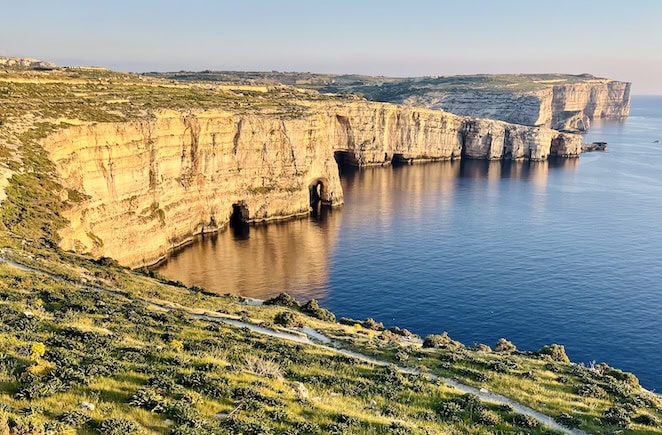
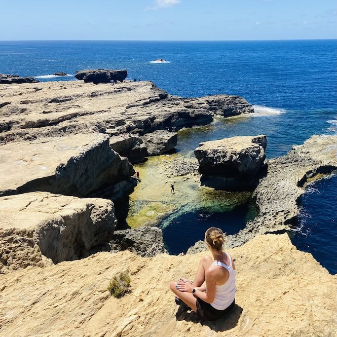
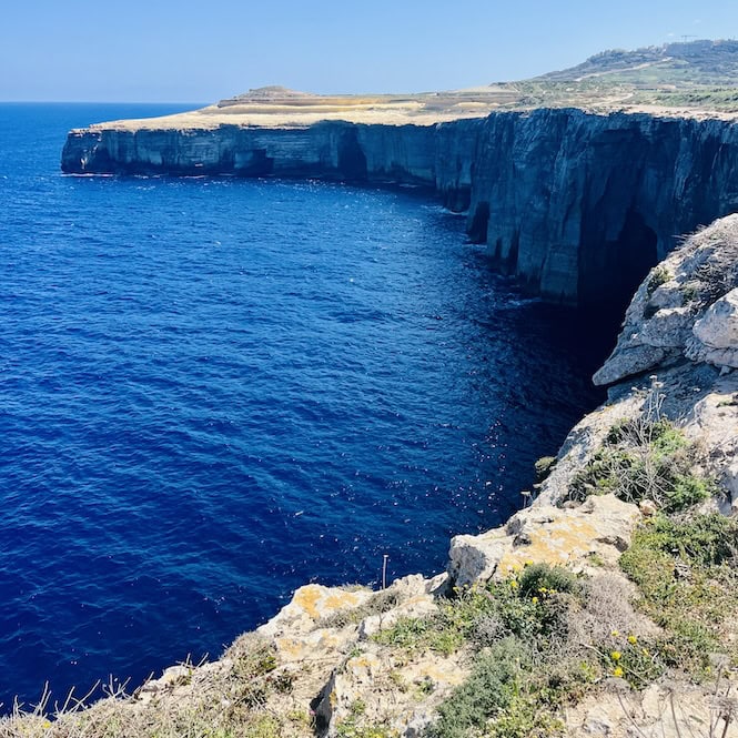
Approaching Xlendi, you’ll walk along the famous Sanap Cliffs. They are the coast’s highest. These cliffs offer wide views and are ideal for birdwatching.
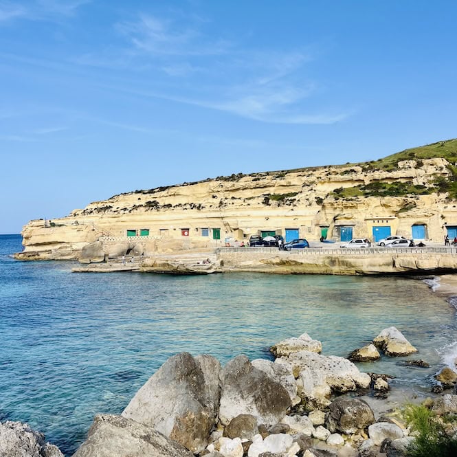
The trail then descends towards Xlendi Tower, the oldest watchtower on Gozo, dating back to 1650. From here, a short walk across a small bridge leads you to the charming seaside village of Xlendi, where you can grab some food, and buy water and snacks.
The Mġarr Harbour to Xlendi hike is also perfect for a half-day adventure. It’s 12 km long and it takes around 3-4 hours to complete it.
Xlendi to Dwejra Bay
Continue your adventure from Xlendi. Head right and follow a small path to a cave. Instead of going all the way to the cave, climb up the hill, keeping an eye out for the red dots that will guide your way.
The ascent takes about 5 to 10 minutes, rewarding you with a breathtaking view of Xlendi Bay.
As you keep walking along the coast, the red dots will guide you. The trail follows the seaside, offering stunning views of the cliffs.
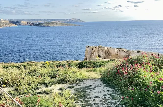
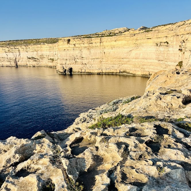
The hike from Xlendi to Dwejra is about 8 km. It takes just over two hours. As you approach Dwejra Bay, you’ll notice a watchtower in the distance, as well as the famous Fungus Rock.
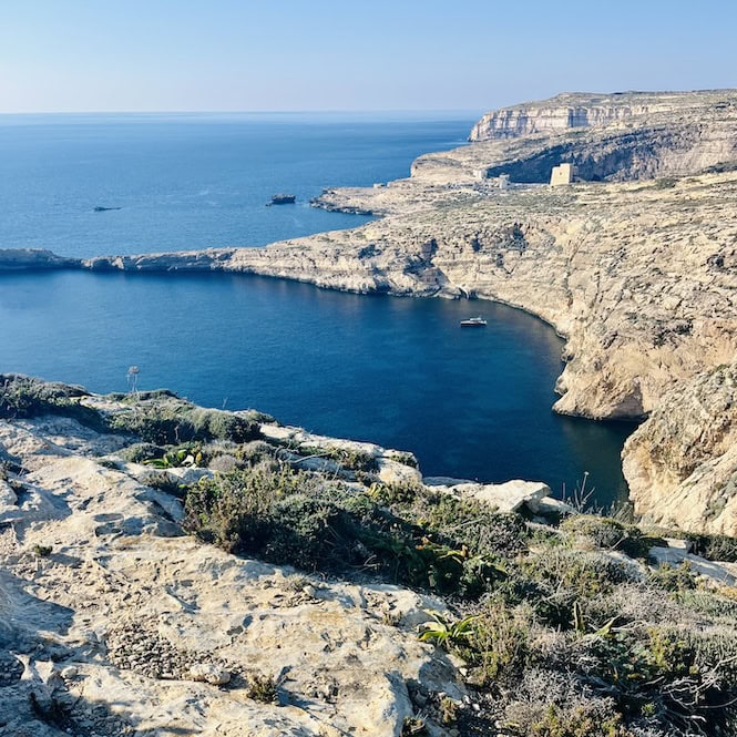
This rock is named after a rare fungus. The fungus grows on the rock’s surface. It was once highly prized for its supposed healing powers. The Knights of Malta even posted guards to protect the fungus from theft.
There is another rock formation not too far from Fungus Rock called Crocodile Rock. It is named for its resemblance to a crocodile’s head. Can you spot it?
Once you arrive to Dwejra Bay, you’ll find many amenities. These include toilets, ice cream vendors, and cafes. At the cafes you can grab a sandwich or a coffee. It’s the perfect spot to take a well-deserved break and soak in the amazing surroundings.
While in Dwejra, I recommend visiting the Inland Sea. It’s a saltwater lagoon connected to the open sea by a narrow, 80-meter-long tunnel. The Inland Sea is a popular spot for swimming and boat trips, offering a unique perspective of the area’s geological wonders.
One more amazing spot to visit is the Blue Hole. This natural underwater sinkhole attracts scuba divers from all over the world. It’s best to be seen from the top of the cliffs. For directions, click here.
The Xlendi to Dwejra section is also good for a shorter hike. This is thanks to the good public transport to Xlendi and Dwejra.
Dwejra to Wied il-Mielaħ
As you leave Dwejra behind, you’ll see breathtaking views of the bay. They include the iconic watchtower and the Fungus Rock.
One highlight of this part of the hike is the chance to see a breathtaking sunset.
For those who choose to split the hike into two days, staying in Għarb is a great option. During our hike, we opted for a charming Ta’ Matmura Farmouse.
In the evening, we took a 20-minute walk to the town center. There, we ate delicious fish at a at Gharb Rangers Bar & Restaurant.
The next morning, well-rested and fueled by a big breakfast, we left our farmhouse. We walked for about 10 to 15 minutes to reach our hiking path.
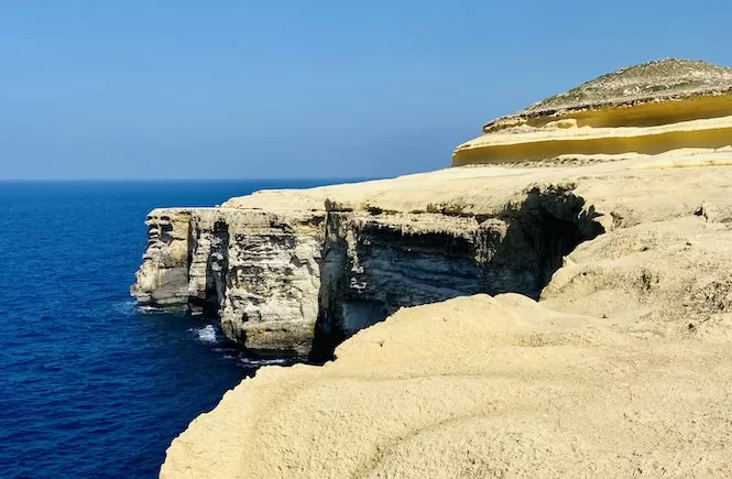
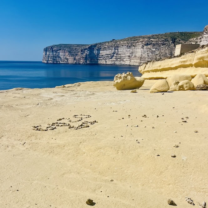
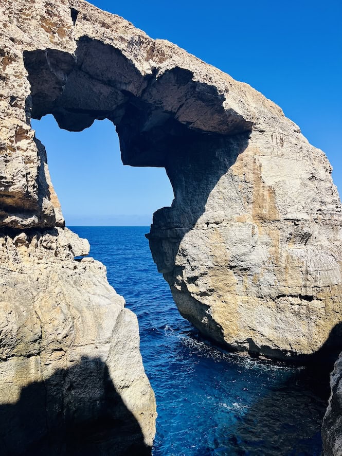
From there, we followed the coast towards Wied il-Mielaħ, taking in the changing scenery along the way. The landscape transformed. It revealed yellow limestone rocks and mushroom-shaped formations.
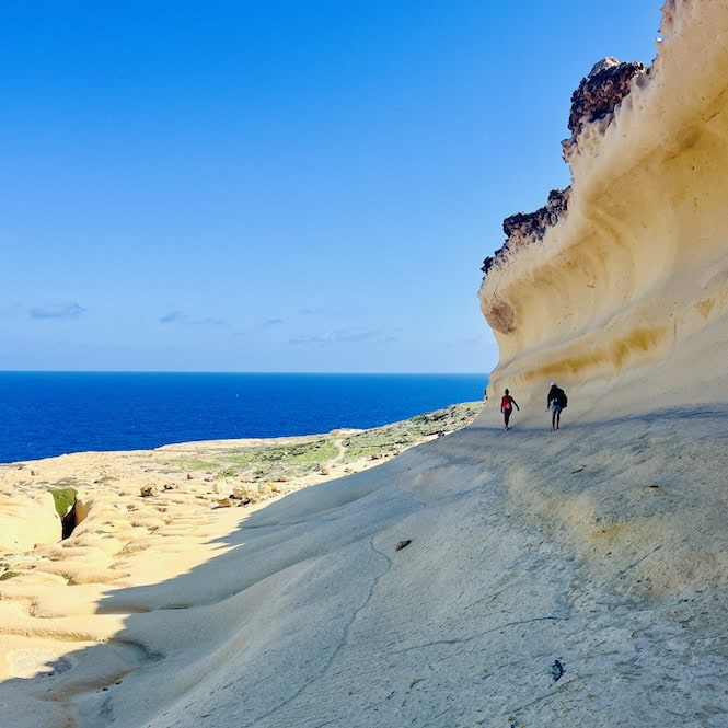
At Wied il-Mielaħ, you can admire the iconic limestone arch. You’ll find some small steps that lead you closer to the arch and the crystal-clear waters below.
The hike from Dwejra to Wied il-Mielaħ covers about 6 km and usually takes around 2 hours to complete. If you plan to walk this route separately, note that there is no public transit to Wied il-Mielaħ. So, you would need to take a cab.
Wied il-Mielaħ to Għasri Valley
Now, let’s leave the beautiful Wied il-Mielaħ behind and head to Għasri Valley. This part of the hike combines coastal views with scenic countryside.
From Wied il-Mielaħ follow a coastal road along the cliffs. The view is stunning. The deep blue sea is filled with sea caves.
As you continue on, the landscape begins to change. You will find yourselves in a more rural setting, with fields of wildflowers.
In just 5-10 minutes, you’ll spot a small path to Għasri Valley. This valley is a hidden beauty, easily overlooked. As you descend, you’ll find a pebble beach, surrounded by tall cliffs.
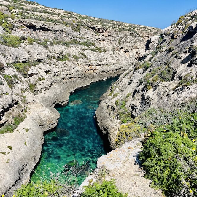
The beach at Għasri Valley is the perfect spot to take a break. You can also take a quick dip.
All in all, the hike section from Wied il-Mielaħ to Għasri Valley covers a distance of around 2-3 kilometers and taking about an hour to complete.
You can only hike this section. It’s an easy two-hour hike. But, keep in mind you’ll need a car or a cab. Public transport does not go to Wied il-Mielaħ or Għasri Valley. I have a hiking guide for Għasri Valley to Wied il-Mielaħ. It includes more details on getting there.
Għasri Valley to Marsalforn
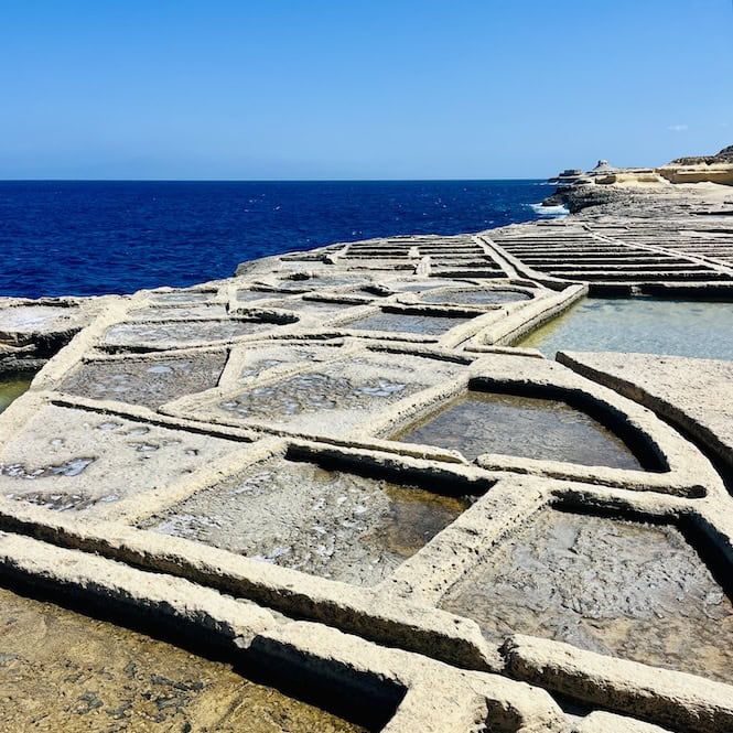
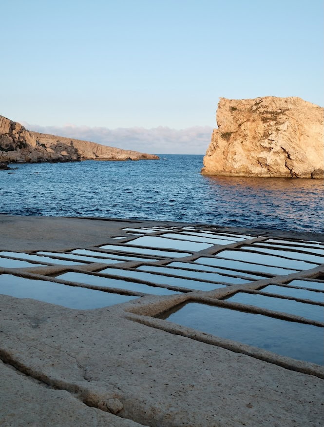
From Għasri Valley, follow the rocky path along the coastline. Soon you will come across a unique Gozitan sight – the salt pans.
The salt pans are a series of shallow, checkerboard-like holes carved into the limestone rock. They are filled with seawater that is left to evaporate under the hot Mediterranean sun.
As the water disappears, salt crystals are left behind, which are then collected by the locals and used for cooking, sold, or exported. It’s a centuries-old tradition that has been passed down through generations, and it’s a fascinating process to witness.
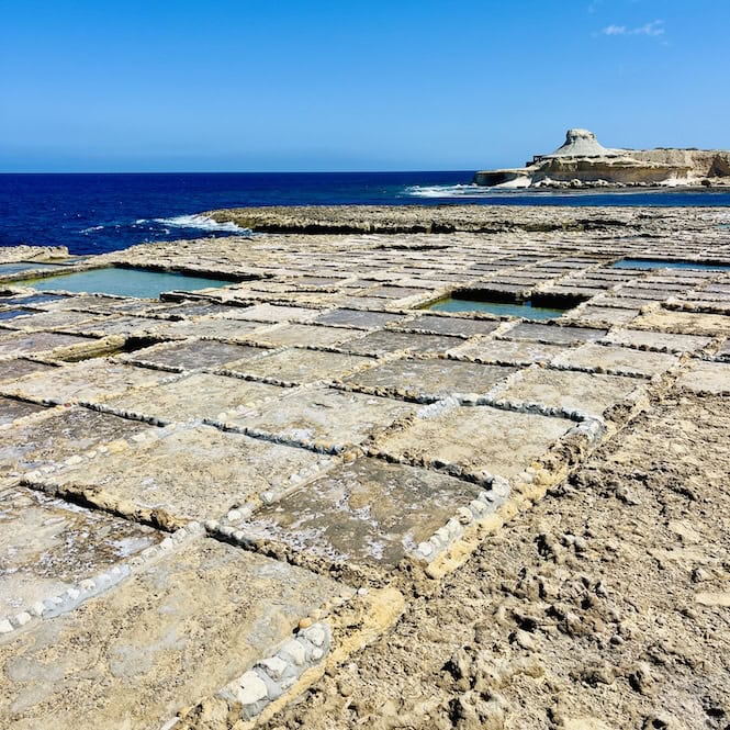
The salt pans stretch for about 3 km. After them, you will arrive at Xwejni Bay. It’s a small but charming inlet that is perfect for a swim. There’s also a small kiosk where you can grab a quick bite to eat or a cold drink before continuing on your way.
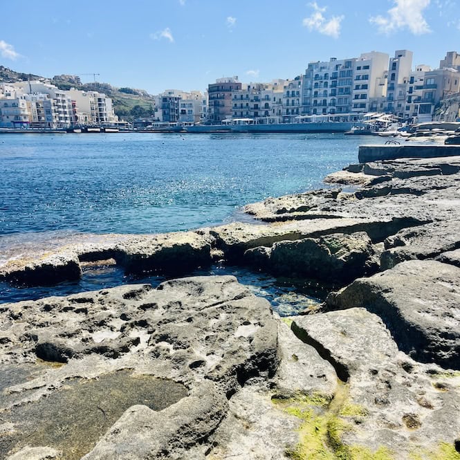
From Xwejni Bay, we follow the coastline again. This time, we head towards Marsalforn, one of the largest towns in Gozo.
Marsalforn is a popular tourist destination. It’s known for its busy promenade, sandy beach, and many restaurants and places to stay. It’s the perfect place to stop for a longer break or even to spend the night if you’re doing a three-day hike.
This section of the hike, from Għasri Valley to Marsalforn, is actually a great option for a shorter, easier walk. I often do this route starting from Xwejni Bay, passing through Għasri Valley, and ending at Wied il-Mielah. It’s a flat and easy trail that is suitable for hikers of all levels.
Marsalforn to Ramla Beach
Leaving Marsalforn, walk along the coast to the last house, which marks the town’s end. Then, start a short, steep climb that takes about 10 minutes. The path is well-used but slippery, especially after rain. So, be careful and walk slowly.
This part of the island is greener and more fertile, especially in November and December. Sometimes, it looks more like Ireland than a Mediterranean island.
If you spot a private property sign, take a detour. Find an alternate path that goes around the restricted area.
After about 30 minutes of hiking, you’ll find a hidden gem: a small, rocky beach. It has no official name, so I call it a secret beach.
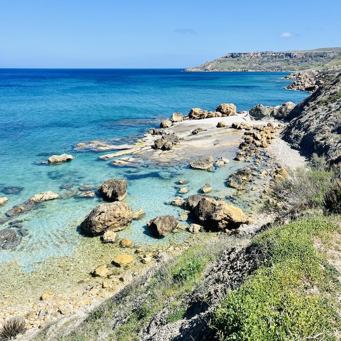
The path to the shore is tricky but worth it. You should take a moment to admire the unique rock formations, especially the circular holes carved by the elements over time.
After leaving the hidden paradise, head to Ramla Beach. You will face another steep hill. It demands caution and patience. But, the view from the top is stunning. It reveals the valleys and the sea.
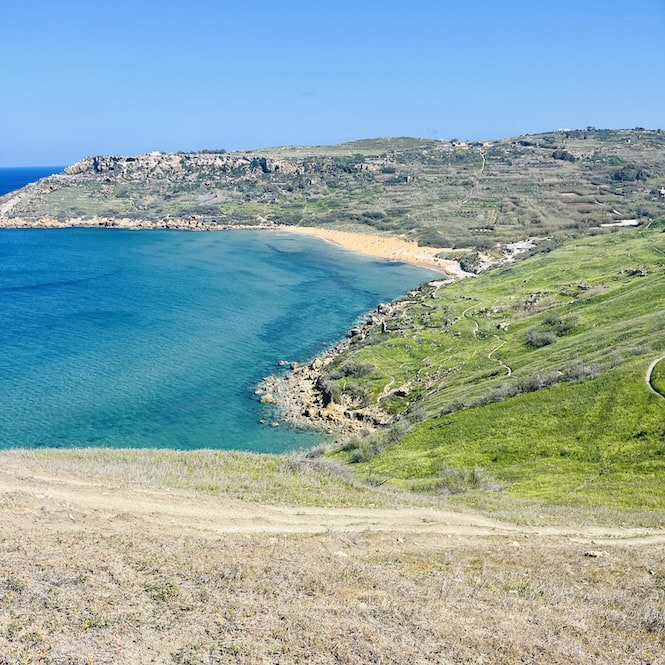
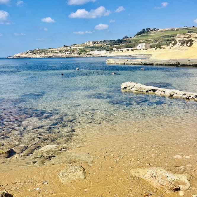
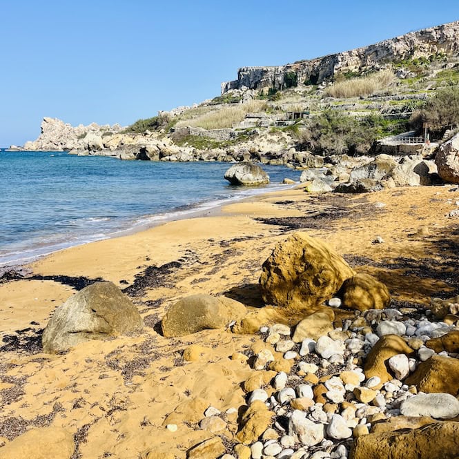
You will soon see Ramla Bay, with its distinctive orange sand glowing in the sunlight. This is one of Gozo’s most iconic red sand beaches, and it’s easy to see why. At Ramla Beach, you can use a toilet. You can also get a drink or have a swim.
You can easily explore this 3 km section on the hike without completing the entire Gozo trek. You can reach Marsalforn using public transport and then catch another bus from Ramla.
Ramla Beach to San Blas
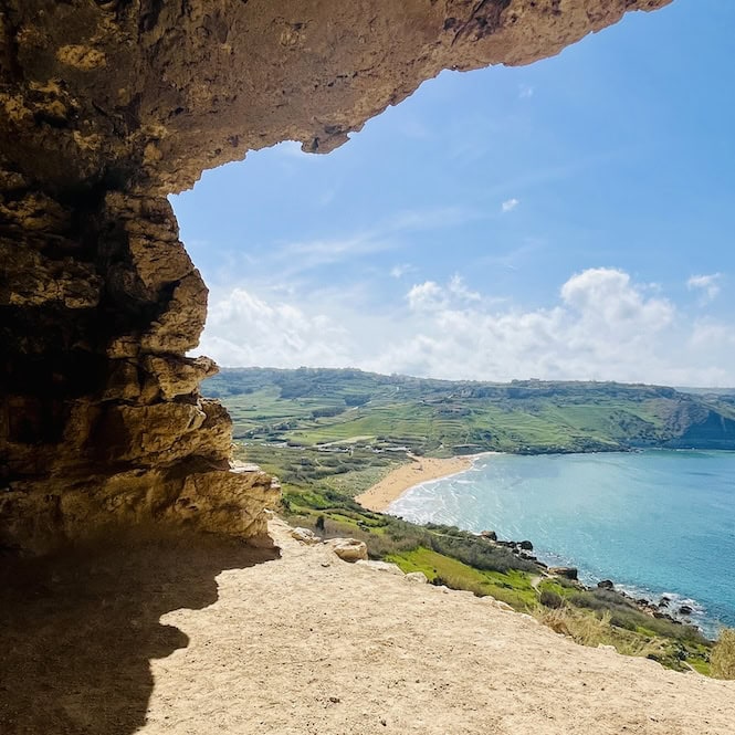
Once you are ready to leave Ramla Beach, walk to the beach’s end. Once you’re there, look for a small path that goes up to Tal Mixta Cave. It’s a short hike, maybe just 10 minutes, but it can be a bit steep and slippery near the end, so be careful and take your time.
Tal Mixta Cave is super popular, and you might even see people getting there by car. It’s like one of those cool Instagram spots everyone wants to snap a picture of.
After you’ve checked out the cave, you’ll follow a village road for a while. So, you won’t be right next to the coastline. But don’t worry; it’s still a nice walk, and the road isn’t too busy with cars.
Keep your eyes peeled for a turn to the left. When you see it, take that turn and get ready to go down an even smaller road. You might see some cars on this road, and it’s pretty amazing that they can even drive on such a narrow steep path!
Now, this is where my map comes in handy. Make sure you follow it closely, and you’ll find your way to San Blas Beach without any trouble. San Blas is a tiny beach with the same red sand as Ramla.
The locals love San Blas Beach, but it never gets too crowded because it’s not the easiest place to get to.
Ramla Beach to San Blas section spans about 3 km. While it has some nice aspects, it may not be the best choice for a hike since you’ll likely be walking along the road most of the time.
San Blas to Hondoq Beach
This part can be quite challenging, because it has the highest elevation gain. It spans 8 km and usually takes about 3 hours to finish.
From San Blas, follow a small road that leads to Nadur. It’s super steep! You’ll quickly understand why this beach isn’t as popular as some others.
It takes about 15 to 20 minutes to climb up, but along the way, you’ll get to see some amazing views of the valley and the beach below. Oh, and keep an eye out for all the cool fruit trees like oranges, figs, pomegranates, and grapes.
Once you reach the top of the hill, you need to go left and try to get back to the coastline. Don’t worry; there’s a nice path that will lead you to Daħlet Qorrot Beach.
The path can be a bit grown over in some parts. There are also a few rocky sections where you’ll need to do a bit of climbing, but it’s nothing too crazy. Just be careful and take your time.
When you finally arrive at Daħlet Qorrot, you’ll see a lovely beach and bunch of boathouses nearby. Take a moment to catch your breath and enjoy the view!
From Daħlet Qorrot Beach, head along the coastline to St. Anthony’s Battery. You’ll pass a quarry with rocks that have a white, moon-like appearance.
Although St. Anthony’s Battery is closed, it’s still pretty to look at. From there, follow the path with the red dots. Be prepared for some rocky sections where you’ll need to climb down, but it’s doable. The coastline starts to change, becoming more varied and scenic.
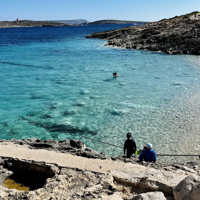
Continue walking along the coast until you come to Ħondoq Bay. On the way on your left you will see the beautiful island of Comino.
Hondoq Bay itself is a pretty small beach, but it’s got a large car park, a restaurant, and a kiosk. It’s always packed with people. Grab a drink and maybe some food. There are even toilets there if you need them.
This section may not be the most suitable for a shorter hike. While the bays are beautiful, there is a significant elevation gain, and you will find yourself walking mostly on small roads. If you prefer a shorter hike, I recommend exploring other sections instead.
Hondoq Bay to Mġarr Harbor
To get there, you’ll follow a path along the coast, and you’ll have the stunning island of Comino on your left the whole time. The path itself is pretty, but you’ll probably be feeling super tired by this point.
Make sure you watch your step and be careful not to trip on any uneven rocks. You don’t want to get hurt when you’re so close to the finish line.
Before you know it, Mġarr Harbor will come into view. If you’re lucky enough to be walking in the evening, you might even get to watch the sunset as you finish your hike.
Now, it’s time to celebrate! You might want to grab a Maltese beer at a bar near the harbor. Or, treat yourself to a delicious Maltese meal.

Exploring Gozo by taking a hike around the entire island is an incredible adventure. You will see stunning cliffs, hidden beaches, charming villages, and meet friendly locals.
You can tackle the full 50-kilometre trek or just a few shorter sections. The trails are easy to follow. With the maps and descriptions in this guide, you’ll never get lost.